The Presidents Tree
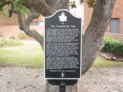
The Estill family was the first presidential family to occupy the home, followed by President Charles N. Shaver and President Harmon Lowman and their respective families. The Lowman family was the last to live in the home, and the descendants remember playing near the Magnolia tree when they were youngsters. They vacated the house in 1964, after which it was used as a home demonstration model for home economic classes until 1970, when it was torn down and removed from campus.
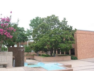
With the dedication of this plaque, the Sam Houston State University Alumni Association hereby designates this stately Southern Magnolia as "The Presidents Tree," and acknowledges its significance in the early life of the university and in the lives of the students, faculty, administrators and friends who have rested in its shade through the years; and further, the Alumni
Association pays tribute to the history that reflects the institution’s past and helps to shape its present and its future.Erected 2004 by SHSU Alumni Association.
Topics. This historical marker is listed in these topic lists: Education • Landmarks. A significant historical year for this entry is 1911.
Location. 30° 42.883′ N, 95° 32.936′ W. Marker is in Huntsville, Texas, in Walker County. Marker is on Avenue J near 19th Street. Located at the northeast corner of Avenue J and 19th Street. Touch for map. Marker is in this post office area: Huntsville TX 77340, United States of America. Touch for directions.
Other nearby markers. At least 8 other markers are within walking distance of this marker. Peabody Library Building (about 400 feet away, measured in a direct line); Austin College Building (about 500 feet away); Old Main Building (about 600 feet away); Law Office (Sam Houston) (approx. 0.2 miles away); Roberts-Farris Log Cabin (approx. ¼ mile away); Margaret Moffette Lea Houston (approx. ¼ mile away); Woodland, Home of Sam Houston (approx. ¼ mile away); Joshua's Forge (approx. ¼ mile away). Touch for a list and map of all markers in Huntsville.
Also see . . . About the Presidents Tree. (Submitted on June 1, 2008, by Buildingshsu of Austin, Texas.)
Credits. This page was last revised on June 20, 2020. It was originally submitted on June 1, 2008, by Buildingshsu of Austin, Texas. This page has been viewed 1,406 times since then and 14 times this year. Last updated on June 27, 2013, by Buildingshsu of Austin, Texas. Photos: 1, 2. submitted on June 1, 2008, by Buildingshsu of Austin, Texas. • Bill Pfingsten was the editor who published this page.

