Near Vienna in Dorchester County, Maryland — The American Northeast (Mid-Atlantic)
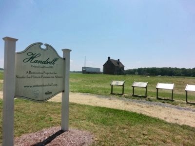
Handsell
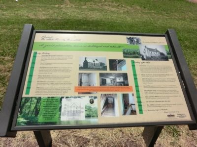
The Steele Family Homestead
— A grand plantation home is destroyed and rebuilt. —
Early History
1768-The Indian Reservation at Chicone was dissolved by the Maryland Colony. 484 acres of Handsell went to Ann Billings and her husband, Henry Steele. According to oral history the Steeles built a “large pretentious home”, now believed to be Handsell.
1776-The 1776 Census lists Henry Steele living in Vienna area with this family and 91 slaves.
1779- The British attack the Vienna area several times between 1779-1781. Considerable damage was done to local homes including Weston, home of the John Henry family nearby. One slave was stolen from Henry Steele. It is possible Handsell was destroyed during that time.
1782-Henry Steele died in February, just 6 months after his dear friend and business partner Colonel John Henry passed away. He left 8000 acres of land and several dozen slaves.
1783-The 1783 Tax Assessment lists Handsell as containing one frame dwelling house, 5 “logged” home, 2 barns and one orchard. Ann Steele died in 1788. Handsell willed to her second son, Isaac.
1800-1800 Census lists Isaac Steele living at Handsell with 14 slaves. In 1803 he purchased property in Cambridge and began to build a large brick house at Hambrooks, but died in 1806 at age 39. Brother James inherited the entire Steele fortune. Handsell continued to be farmed by the Steele family until 1837.
History after 1837
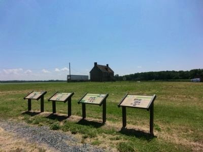
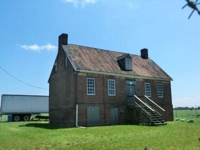
1837-John Steele of Dorchester County purchased and built the present structure from the 18th century brick ruins.
1844-Mileah Ann Steele and her husband Robert Rook lived here until the property was sold to Jacob C. Wilson in 1849.
1859-John Thompson purchased Handsell from Jacob C. Wilson. Thompson died in 1862 and willed Handsell to his son Samuel E. An extant 1877 Map indicates Handsell, known then as the Thompson Farm was occupied by Samuel E. Thompson.
1916-The old brick house was rented by Harry E. and Della Bradshaw Hughes. Della gave birth to her first child, Blanche, on Feb. 9, 1916 while living at Handsell. The Hughes family left Handsell shortly after her birth.
1920’s-Glen and Mary Wilson lived “in the old brick home at Chicone”, and later told the story of the barn burning one night.
1930’s-No one lived at Handsell after this time.
2005-The NHPA is formed to purchase and restore Handsell. It is listed on the State and National Register of Historic Places.
2011-Restoration begins at Handsell
[Captions:]
Although no original plans exist, and there is no record of an architect, the original Handsell is
believed to have been a 5-bay, two-story-with-garret brick home built in the Georgian style popular at the time, as pictured at right in the in the Conceptual Sketch of Handsell.
Sometime between 1770’s and 1803, the original plantation house experienced a devastation and partial collapse. Research and archaeology is ongoing, but it is clear the house was left in ruins with three walls of the house still standing. Was it destroyed by the British during the War or by a house fire?
Erected by Maryland Heritage Area Authority.
Topics. This historical marker is listed in these topic lists: Colonial Era • War, US Revolutionary. A significant historical month for this entry is February 1854.
Location. 38° 30.544′ N, 75° 48.769′ W. Marker is near Vienna, Maryland, in Dorchester County. Marker is on Indiantown Road. Touch for map. Marker is at or near this postal address: 4837 Indiantown Rd, Vienna MD 21869, United States of America. Touch for directions.
Other nearby markers. At least 8 other markers are within 2 miles of this marker, measured as the crow flies. The Nanticoke Historic Preservation Alliance (here, next to this marker); The native people of the Chicacone Village…the Nanticokes (here, next to this marker); The African American Story in the Indian Town (here, next to this marker); Unnacokossimmon (approx. 1.7 miles away); John Smith Explores the Chesapeake
(approx. 1.7 miles away); Discover: Vienna Heritage (approx. 1.8 miles away); A walking tour of Vienna (approx. 1.9 miles away); Discover: Restoration (approx. 1.9 miles away). Touch for a list and map of all markers in Vienna.
Credits. This page was last revised on January 15, 2022. It was originally submitted on July 10, 2013, by Don Morfe of Baltimore, Maryland. This page has been viewed 487 times since then and 12 times this year. Photos: 1, 2, 3, 4. submitted on July 10, 2013, by Don Morfe of Baltimore, Maryland. • Bill Pfingsten was the editor who published this page.


