Wheeling in Livingston County, Missouri — The American Midwest (Upper Plains)
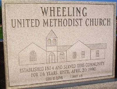
Wheeling United Methodist Church
Established 1874 and served this community for 116 years, until April 20, 1990
John 4:8
Topics. This historical marker is listed in this topic list: Churches & Religion. A significant historical date for this entry is April 20, 1990.
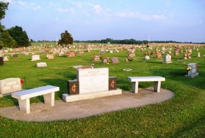
Location. 39° 46.721′ N, 93° 23.329′ W. Marker is in Wheeling, Missouri, in Livingston County. Monument is in Wheeling Cemetery, on US Hwy 36 west of Grant Street (Missouri Hwy B). Touch for map. Marker is in this post office area: Wheeling MO 64688, United States of America. Touch for directions.
Other nearby markers. At least 8 other markers are within 9 miles of this marker, measured as the crow flies. Chillicothe (approx. 5.7 miles away); Locust Creek Covered Bridge (approx. 8.2 miles away); [Covered Bridge] Truss Structures and Truss Variations (approx. 8.2 miles away); The Home of Sliced Bread (approx. 8.7 miles away); The Frank Bench Bakery (approx. 8.7 miles away); Shale Hill Brick & Tile Plant (approx. 8.7 miles away); A Trophy View (approx. 8.7 miles away); Bradley's Saloon (approx. 8.7 miles away).
Also see . . . "Wheeling Township" in History of Livingston County (1886). (Submitted on July 14, 2013, by William Fischer, Jr. of Scranton, Pennsylvania.)
Credits. This page was last revised on December 19, 2020. It was originally submitted on July 14, 2013, by William Fischer, Jr. of Scranton, Pennsylvania. This page has been viewed 325 times since then and 11 times this year. Photos: 1, 2. submitted on July 14, 2013, by William Fischer, Jr. of Scranton, Pennsylvania.

