New Ulm in Brown County, Minnesota — The American Midwest (Upper Plains)
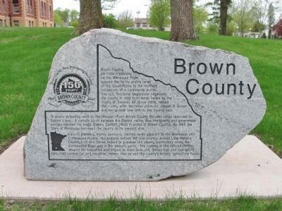
Brown County
150 Years
— 1856 • 2006 —
Inscription.
Brown County, an historic gateway on the Minnesota River, opened the fertile prairie lands of the Great Plains to the northern hardwoods of a continental divide. The U.S. Territorial Legislature organized the county in 1856 from lands ceded by the Treaty of Traverse de' Sioux (1851), named the county after territorial councilor Joseph R. Brown and designated New Ulm as the county seat.
Originally extending west to the Missouri River, Brown County included lands reserved for Dakota tribes. A cultural clash between the Dakota nation, new immigrants and government policies sparked the tragic Dakota Conflict (1862) in areas of Brown County. By 1865 the State of Minnesota narrowed the county to its present size.
Earliest pioneers, mainly Germans, claimed lands adjacent to the Minnesota and Cottonwood Rivers. Norwegians settled the lake country around Lake Hanska. English, Irish and Danes helped to populate the county, particularly along the Cottonwood River and in the western parts. The coming of the railroad (1870s) shaped the townships and helped to make New Ulm, Sleepy Eye and Springfield into chief commercial and industrial centers that served the county's historic agricultural base.
Topics. This historical marker is listed in these topic lists: Native Americans • Settlements & Settlers • Wars, US Indian. A significant historical year for this entry is 1856.
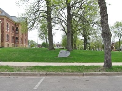
Location. 44° 18.691′ N, 94° 27.699′ W. Marker is in New Ulm, Minnesota, in Brown County. Marker is on South State Street south of Center Street, on the right when traveling south. Marker is on the lawn of the Brown County Courthouse. Touch for map. Marker is at or near this postal address: 14 South State Street, New Ulm MN 56073, United States of America. Touch for directions.
Other nearby markers. At least 8 other markers are within walking distance of this marker. The Pioneers of Brown County Monument (a few steps from this marker); Roebbecke Mill (within shouting distance of this marker); Lest We Forget (within shouting distance of this marker); Brown County Veterans Memorial (within shouting distance of this marker); Defenders State Monument (within shouting distance of this marker); John Lind Home (within shouting distance of this marker); Turner Hall (about 500 feet away, measured in a direct line); Guardians of the Past (about 600 feet away). Touch for a list and map of all markers in New Ulm.
Also see . . . Brown County, Minnesota. Wikipedia entry. (Submitted on July 15, 2013.)
Credits. This page was last revised on June 7, 2021. It was originally submitted on July 15, 2013, by Keith L of Wisconsin Rapids, Wisconsin. This page has been viewed 564 times since then and 25 times this year. Photos: 1, 2. submitted on July 15, 2013, by Keith L of Wisconsin Rapids, Wisconsin.

