Melbourne in Brevard County, Florida — The American South (South Atlantic)
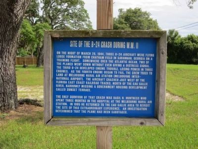
Site of the B-24 Crash During W.W. II
The only survivor of that crash was Basil R. Huntress who spent three months in the hospital at the Melbourne Naval Air Station. In 1995 he returned to the Eau Gallie area to revisit the site of this extraordinary experience. An investigation determined that the plane had been sabotaged.
Topics. This historical marker is listed in these topic lists: Air & Space • War, World II. A significant historical date for this entry is March 26, 1944.
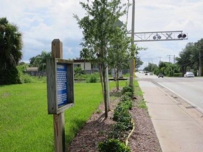
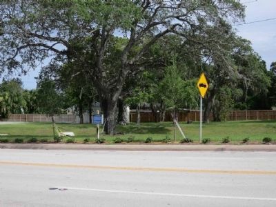
Location. 28° 7.728′ N, 80° 38.023′ W. Marker is in Melbourne, Florida, in Brevard County. Marker is on Eau Gallie Blvd. (County Road 518) 0.2 miles west of U.S. 1, on the right when traveling east. The marker is close to the road on the south side, on a vacant lot just east of the railroad tracks and west of the fire station. Touch for map. Marker is in this post office area: Melbourne FL 32935, United States of America. Touch for directions.
Other nearby markers. At least 8 other markers are within walking distance of this marker. Eau Gallie Yacht Basin (approx. 0.4 miles away); St. John's Episcopal Church (approx. 0.4 miles away); Highland and St. Clair Street (approx. 0.4 miles away); Karrick's Grocery (approx. 0.4 miles away); Ginter Building (approx. 0.4 miles away); Old City Hall Complex (approx. 0.4 miles away); Downtown Eau Gallie (approx. 0.4 miles away); Old Eau Gallie Post Office and Surrounding Area (approx. 0.4 miles away). Touch for a list and map of all markers in Melbourne.
More about this marker. The town of Eau Gallie which existed at the time of the crash is now part of Melbourne.
Credits. This page was last revised on May 18, 2023. It was originally submitted on October 23, 2011, by Jamie Cox of Melbourne, Florida. This page has been viewed 2,386 times since then and 88 times this year. Last updated on May 18, 2023, by Jamie Cox of Melbourne, Florida. Photos: 1, 2, 3. submitted on July 18, 2013, by Jamie Cox of Melbourne, Florida. • J. Makali Bruton was the editor who published this page.


