Yorktown in York County, Virginia — The American South (Mid-Atlantic)
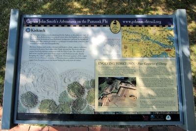
Kiskiack
Captain John Smith’s Adventures on the Pamaunk Flu
— www.johnsmithtrail.org —
Powhatan Indians used surplus corn and shell beads to obtain copper, a substance associated with power, from other tribes. Trade included the Monacan, who got copper from long-distance connections with the Great Lakes. The colonists at Jamestown supplied great amounts of copper to the Powhatan people, thereby disrupting the cultural significance of the metal. Chemical signature of the copper artifacts found at Kiskiack, as well as at Werowocomoco, confirm that Jamestown copper from European mines was traded during the early years of contact.
Capt. John Smith’s Trail
John Smith knew the York river and its tributaries by their Algonquian name: the Pamaunk Flu. Smith traveled these rivers and the Chesapeake Bay many times between 1607 and 1609, trading with Virginia’s Indians to ensure the survival of the young English colony. What he saw of Virginia’s verdant woodslands and pristine waters inspired him to chronicle its natural wonders.
Captain John Smith’s Trail on the Pamaunkey Flu is a 36-site water trail and auto tour for modern explorers.
(sidebar)
Evolving Yorktown – Four Centuries of Change
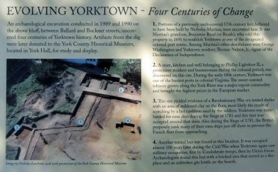
An archaeological excavation conducted in 1989 and 1990 on the above bluff, between Ballard and Buckner streets, uncovered four centuries of Yorktown history. Artifacts from the dig were later donated to the York County Historical Museum, located in York Hall, for study and display.
1. Portions of a previously undiscovered 17th century fort, believed to have been built by Nicholas Martiau, were uncovered here. It was Martiau’s grandson, Benjamin Read (or Reade), who sold this property in 1691 to establish Yorktown as one of the designated colonial port towns. Among Martiau’s other descendants were George Washington and Yorktown resident, Thomas Nelson, Jr., signer of the Declaration of Independence.
2. A store, kitchen and well belonging to Philip Lightfoot II, a prominent resident and businessman during the colonial period, was discovered on this site. During the early 18th century, Yorktown was one of the busiest ports in colonial Virginia. The sweet-scented tobacco grown along the York River was a major export commodity and brought the highest prices in the European market.
3. This site yielded evidence of a Revolutionary War era tented shelter with an area of reddened clay on the floor, most likely the result of scorching by a hot cauldron used by the soldiers. Yorktown was bombarded for nine days during the Siege of 1781 and this tent was occupied around that time. Also during the Siege of 1781, the British purposely sank many of their own ships just off short to prevent the French fleet from approaching.
4. Another tented hut was found at this location. It was occupied almost 100 years later during the Civil War when Yorktown again saw military occupation, first by Confederate troops, then by Union forces. Archaeologists found this hut with a bricked area that served as a fireplace and an unbroken gin bottle on the hearth.
(caption)
Image by Nicholas Luccketti, used with permission of the York County Historical Museum.
Erected by Captain John Smith’s Trail, Virginia Department of Conservation & Recreation, York County. (Marker Number 32.)
Topics. This historical marker is listed in these topic lists: Colonial Era • Exploration • Settlements & Settlers. A significant historical year for this entry is 1607.
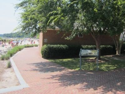
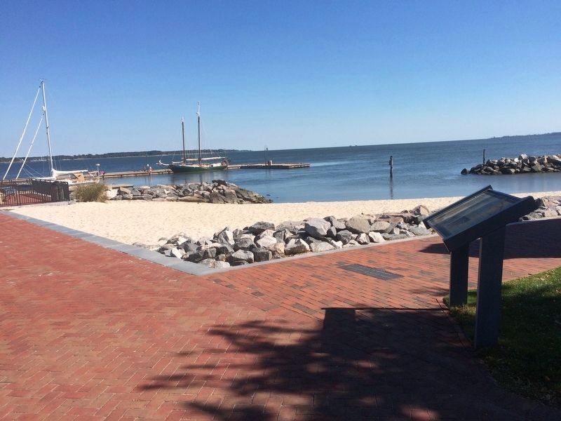
Location. 37° 14.278′ N, 76° 30.446′ W. Marker is in Yorktown, Virginia, in York County. Marker can be reached from the intersection of Water Street and Ballard Street, on the right when traveling west. Located along Yorktown's Riverwalk. Touch for map. Marker is in this post office area: Yorktown VA 23690, United States of America. Touch for directions.
Other nearby markers. At least 8 other markers are within walking distance of this marker. The York River (a few steps from this marker); York River Ecosystem (a few steps from this marker); USS Yorktown (within shouting distance of this marker); Seat of the County of York (within shouting distance of this marker); Kiskiak Indians (within shouting distance of this marker); Virginia Institute of Marine Science (within shouting distance of this marker); Heavy Artillery at Yorktown (about 400 feet away, measured in a direct line); Wars & Yorktown (about 400 feet away). Touch for a list and map of all markers in Yorktown.
Also see . . . Captain John Smith Chesapeake National Historic Trail. Natoinal Park Service (Submitted on July 21, 2013.)
Credits. This page was last revised on November 14, 2021. It was originally submitted on July 21, 2013, by Bernard Fisher of Richmond, Virginia. This page has been viewed 710 times since then and 55 times this year. Photos: 1, 2, 3. submitted on July 21, 2013, by Bernard Fisher of Richmond, Virginia. 4. submitted on November 30, 2016, by J. Makali Bruton of Accra, Ghana.


