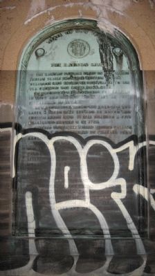
Edison in Middlesex County, New Jersey — The American Northeast (Mid-Atlantic)
The Raritan River
The Raritan Indians lived in this valley. Indian trails from the Hudson to the Delaware and from the mountains to the sea crossed the river near here.
Henry Hudson discovered the Raritan in 1609 and the English settled at Piscataway in 1667.
New Brunswick, where the ford was and later a ferry, was settled by Dutch and English about 1680. It was granted a city charter by George II in 1730.
Rutgers University, called Queens College until 1825, was granted a charter from George III in 1766.
Washington was in the city in 1775 on his way to take command of the army at Cambridge and in 1776 with his army in retreat. Here in camp after the battle of Monmouth he celebrated the fourth of July 1778 and here in 1781 he united his forces for march to final victory at Yorktown. The British under Cornwallis and Howe occupied the city December 1776 to June 1777.
The Raritan River was an important waterway for colonial travel and trade, for early steam navigation, and from 1834 for great traffic of the Delaware and Raritan Canal.
Erected 1929 by State of New Jersey.
Topics. This historical marker is listed in these topic lists: Bridges & Viaducts • Colonial Era • Native Americans • War, US Revolutionary. A significant historical month for this entry is June 1777.
Location. 40° 29.591′ N, 74° 24.766′ W. Marker is in Edison, New Jersey, in Middlesex County. Marker is on U.S. 1. Northern end of US 1 Northbound over the Raritan, aka Morris Goodkind Bridge. Touch for map. Marker is at or near this postal address: 131 Marina Dr, Edison NJ 08817, United States of America. Touch for directions.
Other nearby markers. At least 8 other markers are within 2 miles of this marker, measured as the crow flies. Invention of the Band-Aid (approx. 0.8 miles away); Colored Burial Ground (approx. 0.9 miles away); Saint James Church (approx. one mile away); The Ravine Bridge (approx. 1.3 miles away); The Indian Trail (approx. 1.3 miles away); New Brunswick (approx. 1˝ miles away); The First Classes of Queen's College (Rutgers University) (approx. 1.6 miles away); New Brunswick Inn Site (approx. 1.6 miles away). Touch for a list and map of all markers in Edison.
More about this marker. Copy of marker is at southern end of bridge.
Also see . . .
1. US 1 NB Raritan River bridge. (Submitted on July 23, 2013, by D Howitt of Bergen County, New Jersey.)
2. Donald and Morris Goodkind Bridges (wikipedia). (Submitted on July 23, 2013, by D Howitt of Bergen County, New Jersey.)
Credits. This page was last revised on October 30, 2022. It was originally submitted on July 23, 2013, by D Howitt of Bergen County, New Jersey. This page has been viewed 744 times since then and 46 times this year. Photo 1. submitted on July 23, 2013, by D Howitt of Bergen County, New Jersey. • Bill Pfingsten was the editor who published this page.
Editor’s want-list for this marker. A wide shot of the marker in context. • Can you help?
