Near Lander in Fremont County, Wyoming — The American West (Mountains)
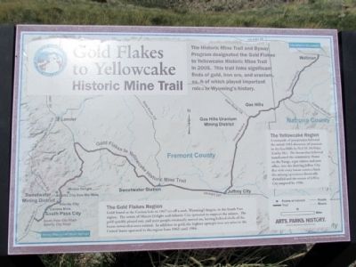
Gold Flakes to Yellowcake Historic Mine Trail
The Gold Flakes Region
Gold found at the Carissa lode in 1867 set off a rush, Wyoming's largest, to the South Pass region. The towns of Miners Delight and Atlantic City sprouted to support the miners. The gold quickly played out, and most people eventually moved on, leaving behind shells of the boom towns that once existed. In addition to gold, the highest open pit iron ore mine in the United States operated in the region from 1962 until 1984.
The Yellowcake Region
A stampede of prospectors followed the initial 1953 discovery of uranium in the Gas Hills by Neil M. McNeice (Lucky Mc). The boom that followed transformed the community Home on the Range, a gas station and post office, into thriving Jeffrey City. But with every boom comes a bust; the mining operations drastically dwindled and the streets of Jeffrey City emptied by 1988.
Erected by Wyoming State Parks & Cultural Resources.
Topics. This historical marker is listed in this topic list: Industry & Commerce. A significant historical year for this entry is 2005.
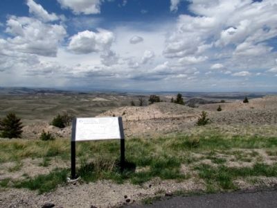
Location. 42° 35.121′ N, 108° 17.425′ W. Marker is near Lander, Wyoming, in Fremont County. Marker can be reached from U.S. 287, 12 miles east of Wyoming Highway 28. Marker is located at scenic pullout on north side of US 287. Touch for map. Marker is in this post office area: Lander WY 82520, United States of America. Touch for directions.
Other nearby markers. At least 8 other markers are within 10 miles of this marker, measured as the crow flies. Beaver Rim and the Wind River Range (here, next to this marker); Sweetwater Station (approx. 5.9 miles away); Sweetwater Willows (approx. 5.9 miles away); Oregon Trail (approx. 5.9 miles away); The Sweetwater Valley (approx. 5.9 miles away); Sixth Crossing (approx. 6.1 miles away); Women of Sixth Crossing (approx. 6.3 miles away); Willie Rescue Site (approx. 10 miles away). Touch for a list and map of all markers in Lander.
Credits. This page was last revised on September 18, 2020. It was originally submitted on July 25, 2013, by Duane Hall of Abilene, Texas. This page has been viewed 685 times since then and 10 times this year. Photos: 1, 2. submitted on July 25, 2013, by Duane Hall of Abilene, Texas. • Syd Whittle was the editor who published this page.

