Near Los Lunas in Valencia County, New Mexico — The American Mountains (Southwest)
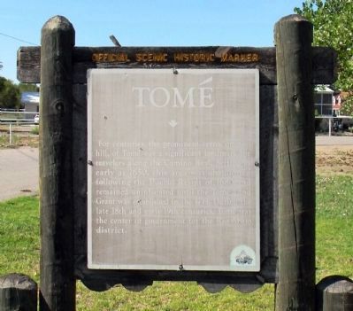
Tomé
Erected by New Mexico Historic Preservation Division.
Topics and series. This historical marker is listed in this topic list: Settlements & Settlers. In addition, it is included in the El Camino Real de Tierra Adentro series list. A significant historical year for this entry is 1650.
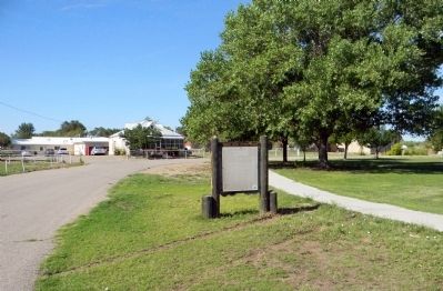
Location. 34° 44.464′ N, 106° 43.823′ W. Marker is near Los Lunas, New Mexico, in Valencia County. Marker is at the intersection of Church Loop and Silva Road, on the left when traveling north on Church Loop. Touch for map. Marker is in this post office area: Los Lunas NM 87031, United States of America. Touch for directions.
Other nearby markers. At least 8 other markers are within 12 miles of this marker, measured as the crow flies. Atchison, Topeka, and Santa Fe Railroad Depot (approx. 3.8 miles away); The Luna Mansion (approx. 4.6 miles away); Valencia (approx. 5 miles away); The Belen Hotel (approx. 6 miles away); Peralta (approx. 7 miles away); Camino del Llano (approx. 7.1 miles away); Vásquez de Coronado's Route (approx. 8.4 miles away); Pueblo of Isleta (approx. 11.3 miles away). Touch for a list and map of all markers in Los Lunas.
Credits. This page was last revised on June 16, 2016. It was originally submitted on July 27, 2013, by PaulwC3 of Northern, Virginia. This page has been viewed 638 times since then and 26 times this year. Photos: 1, 2, 3. submitted on July 27, 2013, by PaulwC3 of Northern, Virginia.
Editor’s want-list for this marker. Clearer Photo of the marker (if/when replaced) • Photos of Tomé Hill • Can you help?


