Near Laclede in Linn County, Missouri — The American Midwest (Upper Plains)
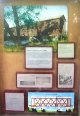
Locust Creek Covered Bridge
Though its present setting suggests otherwise, this bridge was part of "Route 8," the first transcontinental highway in the United States and the primary east-west artery in Linn County. Prior to that designation, "Route 8" played an important part in western migration. As early as 1849, migrants who were caught up in the California gold rush trudged the route toward Independence, Missouri - the eastern end of the Oregon Trail. Locally, the significance of Locust Creek Covered Bridge rests on the utility it rendered to area residents during its 70 years of active service.
Three factors contributed to the bridge's present seclusion. Sometime after 1945 the channel of Locust Creek was altered, leaving the bridge over a dry creek bed. Secondly, U.S. Highway 36, one mile south, replaced old "Route 8." And finally, a second bridge on the west access road washed out; in 1960 the county ceased maintenance of the half-mile access road.
Location
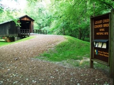
Needless to say, Locust Creek Covered Bridge is hard to find. The "official" directions read...
"In south-central Linn County near Locust Creek, the bridge is located three miles west of Laclede on U.S. Highway 36, one mile north on a gravel road, and east approximately a half-mile on a gravel road that deteriorates into a single-lane dirt road before reaching the bridge."
Construction
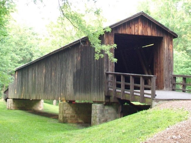
On May 19, 1868, the Linn County Court ordered construction of a covered bridge to span Locust Creek at a cost not to exceed $5,500. The construction firm of Bishop & Eaton was awarded the contract on August 4, 1868, and completed the job later that year. When finished, Linn County Covered Bridge, as it was then known, measured 150 feet long, 16 feet 3 inches wide, and 20 feet 3 inches high.
Preservation
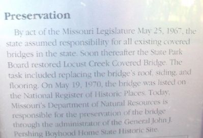
By act of the Missouri Legislature May 25, 1967, the state assumed responsibility for all existing covered bridges in the state. Soon thereafter the State Park Board restored Locust Creek Covered Bridge. The task included replacing the bridge's roof, siding, and flooring. On May 19, 1970, the bridge was listed on the National Register of Historic Places. Today, Missouri's Department of Natural Resources is responsible for the preservation of the bridge through the administration of the General John J. Pershing Boyhood Home State Historic Site.
Erected by Missouri Dept of Natural Resources.
Topics and series. This historical marker is listed in these topic lists: Bridges & Viaducts • Roads & Vehicles. In addition, it is included in the Covered Bridges series list. A significant historical date for this entry is May 19, 1868.
Location. 39° 47.519′ N, 93° 14.075′ W. Marker is near Laclede, Missouri, in Linn County. Marker is near the southwest end of the bridge, about one quarter mile from the parking lot at the east end of Dart Road. The parking lot is about 0.6 miles east of the intersection of Dart Road with Dauber Drive. Touch for map. Marker is in this post office area: Laclede MO 64651, United States of America. Touch for directions.
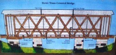
Other nearby markers. At least 8 other markers are within 4 miles of this marker, measured as the crow flies. [Covered Bridge] Truss Structures and Truss Variations (here, next to this marker); Phil Kearny Post No. 19 G.A.R. Memorial (approx. 3.2 miles away); World War II Memorial (approx. 3.2 miles away); Laclede (approx. 3˝ miles away); John Joseph Pershing (approx. 3˝ miles away); General John J. Pershing Boyhood Home (approx. 3˝ miles away); a different marker also named Laclede (approx. 3˝ miles away); a different marker also named Laclede (approx. 3˝ miles away). Touch for a list and map of all markers in Laclede.
More about this marker. There is good signage from US Hwy 36 to the Locust Creek Covered Bridge State Historic Site parking lot.
Also see . . .
1. Locust Creek Covered Bridge National Register Nomination. Missouri State Parks website entry (Submitted on July 31, 2013, by William Fischer, Jr. of Scranton, Pennsylvania.)
2. Locust Grove Covered Bridge State Historic Site MO. Missouri State parks website entry (Submitted on July 31, 2013, by William Fischer, Jr. of Scranton, Pennsylvania.)
Credits. This page was last revised on January 16, 2022. It was originally submitted on July 31, 2013, by William Fischer, Jr. of Scranton, Pennsylvania. This page has been viewed 529 times since then and 16 times this year. Photos: 1, 2, 3, 4, 5, 6, 7, 8. submitted on July 31, 2013, by William Fischer, Jr. of Scranton, Pennsylvania.
