Queenstown in Queen Anne's County, Maryland — The American Northeast (Mid-Atlantic)
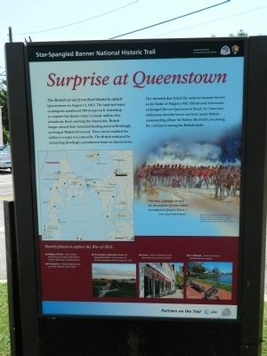
Surprise at Queenstown
Star-Spangled Banner National Historic Trail
— National Park Service, U.S. Department of the Interior —
Erected by National Park Serivce, U.S. Department of the Interior.
Topics. This historical marker is listed in this topic list: War of 1812. A significant historical year for this entry is 1813.
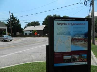
Location. 38° 59.433′ N, 76° 9.458′ W. Marker is in Queenstown, Maryland, in Queen Anne's County. Marker is at the intersection of Main Street and Del Rhodes Avenue on Main Street. Touch for map. Marker is in this post office area: Queenstown MD 21658, United States of America. Touch for directions.
Other nearby markers. At least 8 other markers are within 2 miles of this marker, measured as the crow flies. War in the Chesapeake (here, next to this marker); Colonial Courthouse (a few steps from this marker); Queenstown (a few steps from this marker); Bowlingly (about 500 feet away, measured in a direct line); a different marker also named Bowlingly (about 500 feet away); “Lord’s Gift” (approx. 0.4 miles away); St. Peter’s Church (approx. 1.6 miles away); Battle of Slippery Hill (approx. 1.8 miles away). Touch for a list and map of all markers in Queenstown.
More about this marker. Three-sided marker, with "Oh Say Can You See" and "War on the Chesapeake"

Photographed By Nate Davidson, August 2, 2013
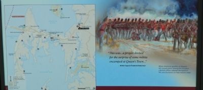
2. Map & Artist's Rendering
"This was ... a project devised for the surprise of some militia encamped at Queen's Town ..." - British Captain Frederick Robertson.
When American gunfire at Slippery Hill caused panic among the invaders, a British officer ordered the band of fife and drummers to help restore order.
Credits. This page was last revised on April 16, 2024. It was originally submitted on August 3, 2013, by Nathan Davidson of Salisbury, Maryland. This page has been viewed 757 times since then and 16 times this year. Photos: 1, 2, 3, 4. submitted on August 3, 2013, by Nathan Davidson of Salisbury, Maryland. • Bill Pfingsten was the editor who published this page.


