Sullivans Island in Charleston County, South Carolina — The American South (South Atlantic)
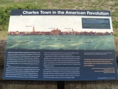
Charles Town in the American Revolution
British and American forces struggled for control of this strategic city throughout America’s quest for independence. The Revolution in South Carolina began in 1775 when Patriot leaders overthrew the British colonial government in Charles Town. The following year, a large British force attacked to regain control of the seaport, rally Loyalist support, and eventually restore British rule. On June 28, 1776, Patriots here on Sullivan’s Island repelled the attacks to win one of America’s first great victories of the war.
Charles Town was relatively calm for the next three years while the British concentrated their war effort in the Northern states. After General Washington’s army fought the British to a stalemate in the North, South Carolina became the main battleground of the American Revolution. British troops threatened Charles Town again in 1779, before Generals Clinton and Cornwallis captured the city with an overwhelming force in 1780. The surrender of Charles Town and nearly 6,000 soldiers was the American’s greatest single loss of manpower during the war.
While patriots in Charles Town suffered under British military occupation, the British army and Loyalists under Lord Cornwallis fought their way through the Carolinas in hundreds of battles, skirmishes, and guerilla actions. Men, women, and children on both sides endured terrible hardships and brutality. After a year of relentless resistance, Cornwallis moved into Virginia and was defeated at Yorktown.
Meanwhile, American troops led by General Nathanael Greene gradually drove British forces remaining in South Carolina back to their last refuge in the occupied city of Charles Town. The long and grueling struggle ended in December 1782 when the British evacuated, sailing past Sullivan’s Island and leaving the Americans in control. With the successful conclusion of the war in 1783, the new nation was free to pursue its revolutionary ideals.
“ We hold these truths to be self-evident, that all men are created equal, that they are endowed by their Creator with certain unalienable Rights, that among these are Life, Liberty and the pursuit of Happiness” .
United States Declaration of Independence
Adopted July 4th, 1776
Six days after the American victory
on Sullivan’s Island
( Sidebar : )
Beautiful sophisticated Charles Town was one of the largest and wealthiest cities in British North America. It was the capital of South Carolina and the cultural and commercial hub of the Southern colonies. Controlling the city and its vital seaport was essential to winning the war.
“ . . . in grandeur, splendor of buildings, decorations, equipages, numbers, commerce, shipping, and indeed in almost every thing, it far surpasses all I ever saw, or ever expect to see, in America.”
Topics and series. This historical marker is listed in this topic list: War, US Revolutionary. In addition, it is included in the Former U.S. Presidents: #01 George Washington series list. A significant historical month for this entry is June 1777.
Location. 32° 46.487′ N, 79° 48.868′ W. Marker is on Sullivans Island, South Carolina, in Charleston County. Marker is on Jasper Boulevard (State Highway 703), on the right when traveling east. Marker is located in Thomson Park. Touch for map. Marker is in this post office area: Sullivans Island SC 29482, United States of America. Touch for directions.
Other nearby markers. At least 8 other markers are within 2 miles of this marker, measured as the crow flies. Victory at Breach Inlet (here, next to this marker); Battle of Sullivan’s Island (here, next to this marker); Liberty or Death (here, next to this marker); Thomson Park (here, next to this marker); Breach Inlet / Military History (a few steps from this marker); British Attack at Breach Inlet / Battery Marshall (a few steps from this marker); Lord Cornwallis (approx. 0.4 miles away); African American Cemetery (approx. 1½ miles away). Touch for a list and map of all markers in Sullivans Island.
More about this marker. The

Photographed By Bill Coughlin, August 3, 2013
3. Palmetto Log Fortification
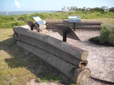
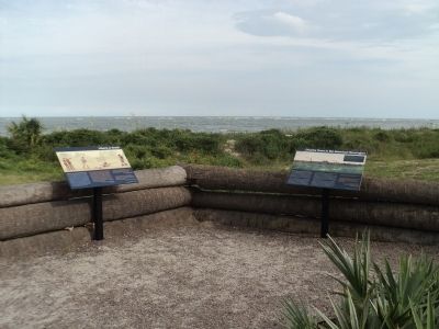
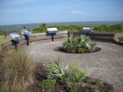
The Charles Town in the American Revolution marker (seen at upper center) is located in a reconstructed palmetto log fortification meant to represent one of two such fortifications built on this site during the American Revolution.
Credits. This page was last revised on November 2, 2020. It was originally submitted on August 3, 2013, by Bill Coughlin of Woodland Park, New Jersey. This page has been viewed 893 times since then and 47 times this year. Photos: 1, 2. submitted on August 3, 2013, by Bill Coughlin of Woodland Park, New Jersey. 3. submitted on September 2, 2013, by Bill Coughlin of Woodland Park, New Jersey. 4. submitted on August 3, 2013, by Bill Coughlin of Woodland Park, New Jersey.


