Winnemucca in Humboldt County, Nevada — The American Mountains (Southwest)
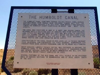
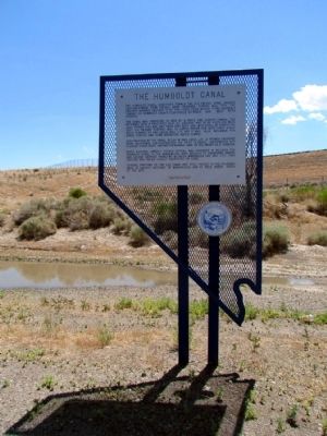
The Humboldt Canal
The canal was conceived in 1862 by A. Gintz and Joseph Ginaca. The waterway with a projected cost of $160,000 was to be sixty-six miles long, fifteen feet wide and three feet deep, and with a fall of thirty-five feet. Its primary purpose was to supply water for over forty stamp mills planned at and above Mill City, but it was also designed for barge traffic and some irrigation water supply.
Construction of the canal began in 1863. Louis Lay, a French emigrant from California, sub-contracted the first segment. Winnemucca city founder Frank Baud, another Frenchman, came on the project as a teamster.
About $100,000, largely French capital, was expended in building the Humboldt Canal to the Winnemucca area. Because of engineering errors and severe seepage problems between Winnemucca and Mill city, that section was never finally completed or used.
Several portions of the old canal are stil visible in the Golconda area, in various sections of Winnemucca, and at Rose Creek, south of the city.
Erected by Nevada State Park System. (Marker Number 21.)
Topics. This historical marker is listed in this topic list: Waterways & Vessels. A significant historical year for this entry is 1862.
Location. 40° 58.926′ N, 117° 43.601′ W. Marker is in Winnemucca, Nevada, in Humboldt County. Marker is on E. 2nd Street (Nevada Route 289) south of See Drive, on the right when traveling east. Touch for map. Marker is in this post office area: Winnemucca NV 89445, United States of America. Touch for directions.
Other nearby markers. At least 8 other markers are within walking distance of this marker. Winneva Building (approx. ¾ mile away); Butch Cassidy's Wild Bunch Bank Robbery (approx. ¾ mile away); a different marker also named Humboldt Canal (approx. ¾ mile away); Great Black Stone (approx. ¾ mile away); Winnemucca World War I American Legion Honor Roll (approx. ¾ mile away); Winnemucca to the Sea Highway (approx. 0.8 miles away); California Trail - Trading Post (approx. 0.8 miles away); Site of school house (approx. 0.8 miles away). Touch for a list and map of all markers in Winnemucca.
Also see . . . Humboldt Canal Map. From the website of the Humboldt Museum. (Submitted on August 7, 2013, by Duane Hall of Abilene, Texas.)
Credits. This page was last revised on June 16, 2016. It was originally submitted on August 7, 2013, by Duane Hall of Abilene, Texas. This page has been viewed 585 times since then and 20 times this year. Photos: 1, 2, 3. submitted on August 7, 2013, by Duane Hall of Abilene, Texas.


