Sullivans Island in Charleston County, South Carolina — The American South (South Atlantic)
Palmetto Fort
1776
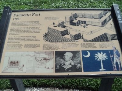
In 1776 South Carolinians prepared for a British invasion by building a fort on this site. This key position on Sullivans Island, beside the main ship channel, protected the entrance to Charleston Harbor.
The fort was designed as a 500-foot square with a bastion at each corner. To build it, thousands of palmetto logs were cut and rafted to Sullivans Island. With double log walls standing 10 feet high, 16 feet apart, and filled with sand, the structure resembled an “immense pen.”
On June 28, Colonel William Moultrie and the garrison of the palmetto log fort successfully defended Charleston against a British fleet. Later, Moultrie was promoted to general, and the fort was renamed to honor him.
( Sidebar : )
Above a map of the fort: This map shows the location and unfinished condition of the palmetto log fort in 1776 when the British fleet arrived. One corner of the fort is illustrated in the drawing above.
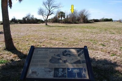
The fort stood near the site of the present-day Fort Moultrie III, but the exact location of the palmetto fort remains unknown.
Above a picture of William Moultrie: Charleston-born Colonel William Moultrie supervised the fort’s hurried construction. The fort did not look formidable, but Moultrie felt it would protect his men. When the British fleet arrived in June 1776, only half of the fort was complete, and the 400-man garrison had little ammunition and only 31 cannon (the British had nearly 300 guns).
Above an image of the South Carolina Flag and a Revolutionary War soldier: The South Carolina state flag; its blue field, white crescent, and palmetto tree represents the Revolutionary War battle fought here in 1776. The tree represents the fort’s palmetto logs; and the crescent and blue color symbolize elements of the soldiers’ uniforms. South Carolina adopted the flag in 1861.
Erected by National Park Service.
Topics. This historical marker is listed in these topic lists: Forts and Castles • War, US Revolutionary. A significant historical month for this entry is June 1864.
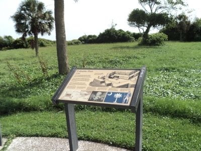
Location. 32° 45.493′ N, 79° 51.465′ W. Marker is on Sullivans Island, South Carolina, in Charleston County. Marker can be reached from Poe Avenue, on the left when traveling west. Marker is located in front of Fort Moultrie. Touch for map. Marker is in this post office area: Sullivans Island SC 29482, United States of America. Touch for directions.
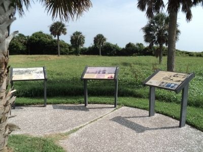
Other nearby markers. At least 8 other markers are within walking distance of this marker. British Attack (here, next to this marker); Charleston Surrenders (here, next to this marker); Revolutionary War Artillery (within shouting distance of this marker); Fort Moultrie II (within shouting distance of this marker); 1860 Flanking Caponniere (within shouting distance of this marker); The Hunley Recovery Project (about 300 feet away, measured in a direct line); Discovering the Hunley (about 300 feet away); H.L. Hunley Disappears (about 300 feet away). Touch for a list and map of all markers in Sullivans Island.
More about this marker. A picture at the top of the marker shows soldiers inside the palmetto fort. It has a caption of “The fort’s double walls, built of spongy palmetto logs and filled with sand (see cutaway), absorbed the impact of enemy projectiles.”
Also see . . . Fort Moultrie. National Park Service website. (Submitted on August 7, 2013, by Bill Coughlin of Woodland Park, New Jersey.)
Credits. This page was last revised on June 16, 2016. It was originally submitted on August 7, 2013, by Bill Coughlin of Woodland Park, New Jersey. This page has been viewed 964 times since then and 80 times this year. Photos: 1, 2, 3. submitted on August 7, 2013, by Bill Coughlin of Woodland Park, New Jersey. 4. submitted on August 11, 2015, by Brandon Fletcher of Chattanooga, Tennessee.


