Near Pleasanton in Linn County, Kansas — The American Midwest (Upper Plains)
Confederate Defeat
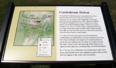
Although the Confederates greatly outnumbered the Union troops at Mine Creek, the Union army clearly had an advantage with its weapons. The Confederates were armed with long muzzle-loading infantry rifles, which were difficult to reload on horseback. They were no match for the Union troops' shorter breech-loading carbines, which were quickly reloaded at the rear of the barrel. Many Confederates fired one shot then turned their horses and fled. Others stayed and used their rifles as clubs when the two forces, still astride their horses, clashed in fierce hand-to-hand combat.
A number of Union troops gained position behind the Confederates and hand-to-hand combat erupted near the creek. The steep creek banks were slippery and crumbling from the recent rain, the rushing water was deep, and wagons blocked the route. Union troops took advantage of the situation and captured many prisoners, including Major General Marmaduke.
By 11:30 a.m. the Confederates were in full retreat with Union forces close behind. Later that evening Price gave orders to burn half the wagons so the army could travel faster.
Erected 2012 by Kansas State Historical Society.
Topics. This historical marker is listed in these topic lists: War, US Civil • Women.
Location. 38° 8.687′ N, 94° 43.393′ W. Marker is near Pleasanton, Kansas, in Linn County. Marker is southeast of the Mine Creek Battlefield State Historic Site visitor center. Touch for map. Marker is at or near this postal address: 20485 Kansas Highway 52, Pleasanton KS 66075, United States of America. Touch for directions.
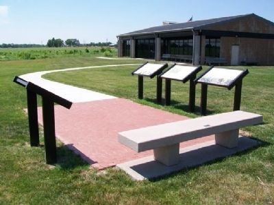
Other nearby markers. At least 8 other markers are within walking distance of this marker. The Battle Begins (here, next to this marker); After the Battle (here, next to this marker); The Fort Scott Road (a few steps from this marker); Two Mounted Armies Collide (a few steps from this marker); Battle of Mine Creek (within shouting distance of this marker); Mine Creek Battlefield Aerial Overlay (within shouting distance of this marker); Combat at State Line (within shouting distance of this marker); Price's Raid (within shouting distance of this marker). Touch for a list and map of all markers in Pleasanton.
Also see . . .
1. Battle of Mine Creek, Kansas. Community Conflict website entry (Submitted on August 8, 2013, by William Fischer, Jr. of Scranton, Pennsylvania.)
2. Mine Creek Battlefield State Historic Site, Kansas. Kansas Historical Society website entry (Submitted on August 8, 2013, by William Fischer, Jr. of Scranton, Pennsylvania.)
3. John Sappington Marmaduke (1833-1887). Encyclopedia of Arkansas website entrty (Submitted on August 8, 2013, by William Fischer, Jr. of Scranton, Pennsylvania.)
Credits. This page was last revised on January 16, 2022. It was originally submitted on August 8, 2013, by William Fischer, Jr. of Scranton, Pennsylvania. This page has been viewed 422 times since then and 11 times this year. Photos: 1, 2. submitted on August 8, 2013, by William Fischer, Jr. of Scranton, Pennsylvania.

