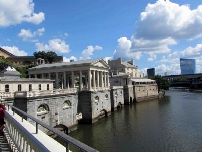
Fairmount Park in Philadelphia in Philadelphia County, Pennsylvania — The American Northeast (Mid-Atlantic)
Fairmount Dam
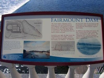
The steam engine originally used to pump river water up to the Reservoir were dangerous and expensive to operate. Because of this, the Watering Committee decided to convert the Water Works to water power. The Fairmount Dam was built to achieve this goal.
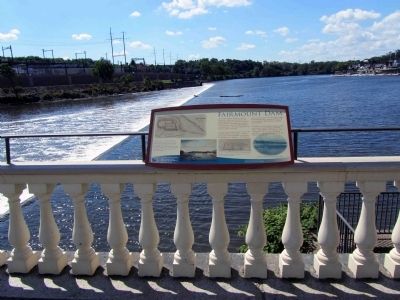
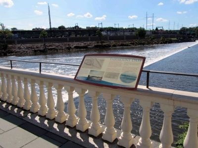
Located to your right, the dam crosses the Schuylkill River at an angle. It diverted the river from its natural channel into the Forebay, now filled-in. At 2,008 feet, this innovative dam was the longest in the United States when completed in 1821. It was designed by Massachusetts engineer Ariel Cooley.
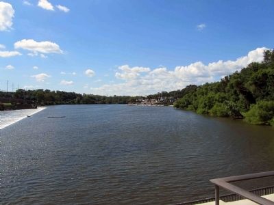
In addition to providing water power, the dam created a pool of calm, pond-like water stretching five miles upriver. The "Fairmount Pool" has been popularly used for boating and recreation from the 1820s to the present.
Erected by Fairmount Park Conservancy.
Topics. This historical marker is listed in these topic lists: Man-Made Features • Waterways & Vessels. A significant historical year for this entry is 1821.
Location. 39° 58.015′ N, 75° 11.077′ W. Marker is in Philadelphia, Pennsylvania, in Philadelphia County. It is in Fairmount Park. Marker can be reached from Waterworks Drive, on the left when traveling north. The interpretive is located on metal railing attached to the top of a wooden balustrade which extends the length of the walkway. The marker is just to the left of the pavilion if facing the Schuylkill River. The dam is off to the left, down below the platform. Touch for map. Marker is at or near this postal address: 640 Waterworks Dr, Philadelphia PA 19130, United States of America. Touch for directions.
Other nearby markers. At least 8 other markers are within walking distance of this marker. How the Water Works Worked / Useful & Beautiful (about 300 feet away, measured in a direct line); The Forebay (about 300 feet away); Engine & Mill Houses (about 300 feet away); Fountain of the Sea Horses (about 400 feet away); Arch & Standpipe (about 400 feet away); William Rush (about 400 feet away); Lafayette (about 400 feet away); Revolutionary War Heroes (about 400 feet away). Touch for a list and map of all markers in Philadelphia.
More about this marker. A hand drawn, black & white map of Fair Mount is in the upper left corner illustrating the river, dam and reservoir as it appeared in 1851. Underneath the map, the caption reads: This 1851 map of the Water Works by Frederick Graff, Jr. shows, from right to left: the locks, dam, mill race (Forebay), Old Mill House (labeled 'mills') and Reservoirs. The dam was built with a sharp angle to permit the breaking-up of sheets of ice when they reached the dam's overfall. This protected the dam from winter damage.
There is a painting in the lower left hand corner with the following caption: In this 1821 painting by Thomas Birch, a steamboat heads towards the canal and lock to pass around the dam.
To the right of this painting, at the bottom middle of the interpretive, is an engineer's rendering of a section of the dam in shallow water with the following caption: The dam was built of cribs of hickory logs filled with stone. These were sunk into the river and fastened to each other and the rock bed of the river.
The third picture on the bottom row is located on the bottom right of the interpretive and features a vintage photo, which caption reads: Workers re-build portions of the dam in 1907.
Image Credits: The "Map of Fairmount" and "Section of Dam": The Historical and Interpretive Collections of the Franklin Institute. Thomas Birch Painting: Pennsylvania of the Fine Arts, Fairmount Park Historic Resource Archive.
Credits. This page was last revised on February 2, 2024. It was originally submitted on August 9, 2013, by Eric Milask of Cherry Hill, New Jersey. This page has been viewed 697 times since then and 58 times this year. Photos: 1, 2, 3, 4, 5. submitted on August 9, 2013, by Eric Milask of Cherry Hill, New Jersey. • Bill Pfingsten was the editor who published this page.
