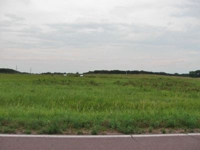
Near Morton in Renville County, Minnesota — The American Midwest (Upper Plains)
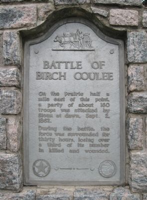
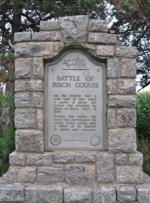
Battle of Birch Coulee
On the prairie half a mile east of this point, a party of about 160 troops was attacked by Sioux at dawn, Sept. 2, 1862.
During the battle, the force was surrounded for thirty hours, losing over a third of its number in killed and wounded.
seal of The Minnesota Historical Society, Instituted 1849
Erected 1950 by the State of Minnesota Department of Highways and Minnesota Historical Society. (Marker Number RN-BCO-004.)
Topics and series. This historical marker is listed in this topic list: Wars, US Indian. In addition, it is included in the Minnesota Historical Society series list. A significant historical month for this entry is September 1821.
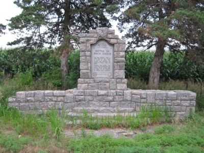
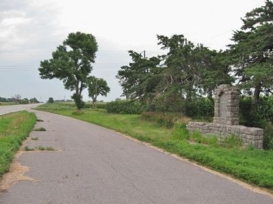
Location. 44° 34.631′ N, 94° 59.658′ W. Marker is near Morton, Minnesota, in Renville County. Marker is on 340th Street (U.S. 71) south of 690th Avenue (County Road 2), on the right when traveling north. Marker is at a highway pull-off. Touch for map. Marker is in this post office area: Morton MN 56270, United States of America. Touch for directions.
Other nearby markers. At least 8 other markers are within walking distance of this marker. A different marker also named The Battle of Birch Coulee (approx. 0.7 miles away); The Prairie Factor (approx. ¾ mile away); “The Fight Was On” (approx. ¾ mile away); Dakota Positions (approx. ¾ mile away); Battle Tactics (approx. 0.8 miles away); Battle Scars (approx. 0.8 miles away); Wrong Place, Wrong Time (approx. 0.9 miles away); "A Beautiful Place to Encamp" (approx. 0.9 miles away). Touch for a list and map of all markers in Morton.
Also see . . .
1. Birch Coulee Historical Marker. Minnesota Department of Transportation Historic Roadside Development Structures Inventory
"The principal feature on the site is a stone marker that is built of pink, gray, and black, rockfaced Morton granite, most of which is coursed... The so-called Battle of Birch Coulee occurred on September 2, 1862, two days after a burial detail of 160 men under the command of Major Joseph R. Brown left Fort Ridgely (near New Ulm) on August 31. The detail buried 16 settlers who had been found dead along the Agency road, and then camped the first evening at the mouth of Birch Coulee. The next day they traveled up the northern side of the river and eastward to the Birch Coulee woods. The detail made camp approximately 200 yards west of the timbered coulee. At dawn on September 2nd, a group of Dakota attacked. The troops were surrounded for over thirty hours, and then eight companies of the 6th and 7th Regiment from Fort Ridgely arrived and the Dakota eventually retreated. There were many casualities on both sides." (Submitted on August 9, 2013.)
2. Birch Coulee Battlefield. Minnesota Historical Society website entry (Submitted on August 9, 2013.)
3. Birch Coulee Battlefield. Wikipedia entry. (Submitted on August 9, 2013.)
Credits. This page was last revised on July 24, 2023. It was originally submitted on August 9, 2013, by Keith L of Wisconsin Rapids, Wisconsin. This page has been viewed 738 times since then and 28 times this year. Photos: 1, 2, 3, 4, 5. submitted on August 9, 2013, by Keith L of Wisconsin Rapids, Wisconsin.
