Wilkes-Barre in Luzerne County, Pennsylvania — The American Northeast (Mid-Atlantic)
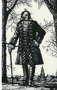
Teedyuscung
(ca. 1700-1763)
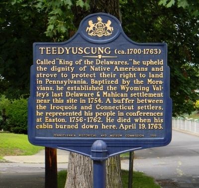
Called “King of the Delawares,” he upheld the dignity of Native Americans and strove to protect their right to land in Pennsylvania. Baptized by the Moravians, he established the Wyoming Valley's last Delaware & Mahican settlement near this site in 1754. A buffer between the Iroquois and Connecticut settlers, he represented his people in conferences at Easton, 1756-1762. He died when his cabin burned down here, April 19, 1763.
Erected 2005 by Pennsylvania Historical and Museum Commission.
Topics and series. This historical marker is listed in this topic list: Native Americans. In addition, it is included in the Pennsylvania Historical and Museum Commission series list. A significant historical month for this entry is April 1861.
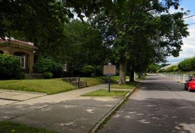
Location. 41° 14.694′ N, 75° 53.693′ W. Marker is in Wilkes-Barre, Pennsylvania, in Luzerne County. Marker is on Riverside Drive, 0 miles south of Sheldon Street, on the left. The marker is across the street from Wyoming Valley Sanitary Authority #12 facility. Touch for map. Marker is in this post office area: Wilkes Barre PA 18702, United States of America. Touch for directions.
Other nearby markers. At least 8 other markers are within walking distance of this marker. Zebulon Butler House (about 700 feet away, measured in a direct line); 30 West River [Street] (approx. 0.2 miles away); Dorothy Dickson Darte Center (approx. 0.2 miles away); American yellowwood (approx. ¼ mile away); Fort Durkee (approx. ¼ mile away); Susquehanna River (approx. ¼ mile away); Class of 1999 Senior Class Gift (approx. ¼ mile away); Hurricane Agnes High Water Mark (approx. ¼ mile away). Touch for a list and map of all markers in Wilkes-Barre.
Also see . . . Teedyuscung. Wikipedia entry (Submitted on February 7, 2023, by Larry Gertner of New York, New York.)
Credits. This page was last revised on February 7, 2023. It was originally submitted on August 13, 2013, by PaulwC3 of Northern, Virginia. This page has been viewed 1,069 times since then and 249 times this year. Photos: 1. submitted on August 13, 2013, by PaulwC3 of Northern, Virginia. 2. submitted on February 7, 2023, by Larry Gertner of New York, New York. 3. submitted on August 13, 2013, by PaulwC3 of Northern, Virginia.


