Auburn in Placer County, California — The American West (Pacific Coastal)
Mountain Quarries Railroad Bridge
Inscription.
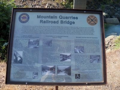
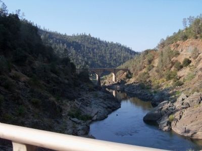
The Mountain Quarries Railroad Bridge, also known a "No Hands Bridge", was completed on March 23, 1912. At the time of its construction the span bore the distinction of being one of the largest reinforced concrete railroad bridges in the United States and the largest such bridge "owned by private capitol." Since 1912, the bridge has withstood the fluctuations of the American River, and managed to stay on its footings when the Hell Hole dam failed in December 1964 destroying two more modern bridges upstream. It also withstood the "Valentines Day Flood" of 1986, which submerged the bridge before destroying a 250 foot earth filled coffer dam two miles downstream. The old concrete bridge stands today as an icon in the American River Canyon and a proud monument to early day engineering innovations and the men who built it.
Erected 2012 by California State Parks. (Marker Number 1051.)
Topics and series. This historical marker is listed in these topic lists: Bridges & Viaducts • Railroads & Streetcars. In addition, it is included in the California Historical Landmarks series list. A significant historical month for this entry is March 1753.
Location. 38° 54.962′ N, 121° 2.427′ W. Marker is in Auburn, California, in Placer County. Marker is on Old Foresthill Road east of Golden Chain Highway (California Highway 49), on the right when traveling east. Coming from Auburn on Hwy 49/193, Old Foresthill Road continues straight but the highway turns right over the river. The monument is about 200 to 300 feet past the intersection. Touch for map. Marker is in this post office area: Cool CA 95614, United States of America. Touch for directions.
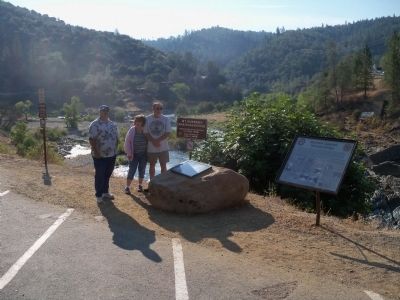
Other nearby markers. At least 8 other markers are within 2 miles of this marker, measured as the crow flies. A different marker also named Mountain Quarries Railroad Bridge (here, next to this marker); The Junction House (approx. one mile away); Auburn Depot (approx. 1.7 miles away); Southern Pacific Caboose (approx. 1.7 miles away); a different marker also named Auburn Depot (approx. 1.7 miles away); Auburn Iron Works (approx. 1.7 miles away); The Chinese Coolie (approx. 1.7 miles away); Marguerite Mine “Quartz Rock” (approx. 1.7 miles away). Touch for a list and map of all markers in Auburn.
Regarding Mountain Quarries Railroad Bridge. National Register of Historic Places #04000014
Also see . . .
1. Iconic Auburn-area Bridge Turns 100. Whatever you may want to call it, Placer County loves its Mountain Quarries Railroad Bridge. Painted, photographed and just plain admired, the span that some dare to call “No Hands Bridge” has reached the spry old age of 100, with plenty of structural stability
left in its concrete-arch frame... (Submitted on August 14, 2013, by James King of San Miguel, California.)
2. Mountain Quarries Railroad Bridge. Construction of this railroad started in 1910, and was used to serve a large quarry near Cool, CA. and haul the limestome mined there to a connection with the SP at Flint (Auburn),CA. The line used 17 trestles, a large triple arch concrete bridge, plus a switchback to make this seven mile trip. The bridge was completed in 1912 by the Pacific Portland Cement Company and service began later the same year. Just east of there the line crosses CA. State Route 49. On one photo caption, it is said that this is the only grade crossing in North America where the trains had to stop for automobiles. Service essentially ended in 1939 and the rails were torn up and scrapped in 1941 for the war effort. Much of the roadbed as well as the "No Hands Bridge" still exists and has been incorporated into the world famous Western States Trail and is used for hiking and equestrian purposes. Portions toward the Auburn end were completely destroyed during preparation for construction of the Auburn Dam. Improvement of the trails continue along with interpretive signs being placed at No Hands Bridge, the Quarry Trail trailhead, and along with park benches, the quarry crusher/loadout. (Submitted on August 14, 2013, by James King of San Miguel, California.)
3. The "No Hands Bridge". On March 23, 2014 this historic bridge was dedicated as California Historical Landmark No. 1051. (Submitted on March 28, 2014.)
Credits. This page was last revised on February 7, 2024. It was originally submitted on August 14, 2013, by James King of San Miguel, California. This page has been viewed 772 times since then and 31 times this year. Photos: 1, 2, 3. submitted on August 14, 2013, by James King of San Miguel, California. • Syd Whittle was the editor who published this page.


