Sharpsburg in Washington County, Maryland — The American Northeast (Mid-Atlantic)
Jackson's Command
Archer's Brigade, Hill's Light Division
Jackson's Command.
Archer's Brigade, Hill's Light Division.
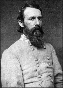
Brig. Gen. J.J. Archer.
Organization.
19th Georgia Infantry,
7th Tennessee Infantry,
14th Tennessee Infantry,
1st Tennessee Infantry, (Provisional Army)
September 17, 1862.
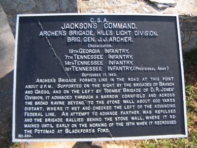
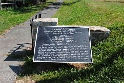
Archer's Brigade formed line in the road at this point about 3 p.m. Supported on the right by the brigades of Branch and Gregg, and on the left by Toombs' Brigade of D.R. Jones' Division, it advanced through a narrow cornfield and across the broad ravine beyond, to the stone wall about 600 yards distant, where it met and checked the left of the advancing Federal line. An attempt to advance farther was repulsed and the brigade rallied behind the stone wall, where it remained until early on the morning of the 19th when it recrossed the Potomac at Blackford's Ford.
Erected by Antietam Battlefield Board. (Marker Number 352.)
Topics and series. This historical marker is listed in this topic list: War, US Civil. In addition, it is included in the Antietam Campaign War Department Markers series list. A significant historical date for this entry is September 17, 1862.
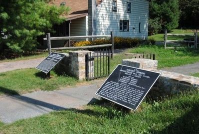
Location. 39° 27.085′ N, 77° 44.813′ W. Marker is in Sharpsburg, Maryland, in Washington County. Marker is on Harpers Ferry Road, on the right when traveling north. Located at the start of a foot path to the Hawkins Zouaves Memorial. Touch for map. Marker is in this post office area: Sharpsburg MD 21782, United States of America. Touch for directions.
Other nearby markers. At least 10 other markers are within walking distance of this marker. Longstreet's Command (here, next to this marker); Kemper's (Va) Brigade (a few steps from this marker); 8th Connecticut Volunteer Infantry (approx. 0.2 miles away); 1st Maryland Artillery (CSA) (approx. 0.2 miles away); Brigadier General Isaac P. Rodman (approx. 0.2 miles away); 9th New York Infantry (approx. 0.2 miles away); a different marker also named Jackson's Command (approx. 0.3 miles away); a different marker also named Jackson's Command (approx. 0.3 miles away); Hill's Light Division, Jackson's Command (approx. 0.3 miles away); Munford's Brigade (approx. 0.3 miles away). Touch for a list and map of all markers in Sharpsburg.
Related markers. Click here for a list of markers that are related to this marker. Follow Archer's Brigade by tablets.
Also see . . .
1. Antietam Battlefield. National Park Service site. (Submitted on March 30, 2008, by Craig Swain of Leesburg, Virginia.)
2. The Tennessee Brigade. Archer was ill on the day of the battle and passed command to Col. Peter Turney of the 1st Tennessee. Archer arrived on the battlefield in an ambulance, and resumed command of the Brigade for the attack. (Submitted on March 30, 2008, by Craig Swain of Leesburg, Virginia.)
3. James J. Archer. James Jay Archer (December 19, 1817 – October 24, 1864) was a lawyer and an officer in the United States Army during the Mexican-American War. He later served as a Brigadier General in the Confederate States Army (CSA) during the American Civil War. (Submitted on October 13, 2015, by Brian Scott of Anderson, South Carolina.)
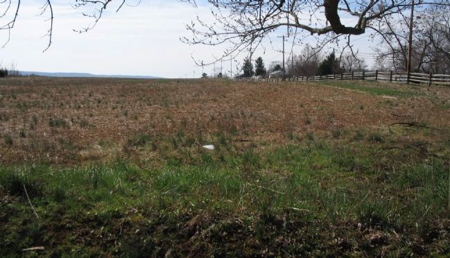
Photographed By Craig Swain, March 29, 2008
6. Archer's Brigade Forms
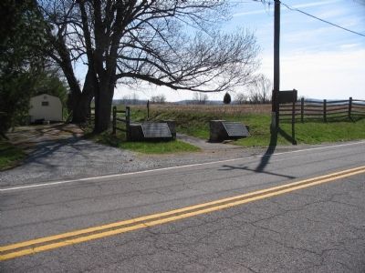
Archer's Brigade formed along Harpers Ferry Road, behind the rail fence on the right. From that line, the Brigade moved forward against the Federals from Rodman's Division, advancing to the stone wall and into the forty acre cornfield before being repulsed.
Credits. This page was last revised on October 23, 2017. It was originally submitted on March 30, 2008, by Craig Swain of Leesburg, Virginia. This page has been viewed 1,044 times since then and 10 times this year. Photos: 1. submitted on March 30, 2008, by Craig Swain of Leesburg, Virginia. 2. submitted on October 13, 2015, by Brian Scott of Anderson, South Carolina. 3. submitted on March 30, 2008, by Craig Swain of Leesburg, Virginia. 4, 5. submitted on October 13, 2015, by Brian Scott of Anderson, South Carolina. 6. submitted on March 30, 2008, by Craig Swain of Leesburg, Virginia.
