Woodley Park in Northwest Washington in Washington, District of Columbia — The American Northeast (Mid-Atlantic)
Redwood
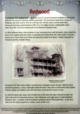
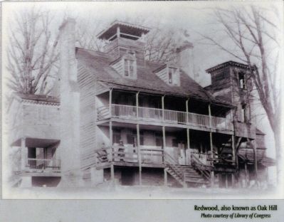
The Woodley Park neighborhood that is now home to several thousand residents as well as the National Zoo was once sparsely settled countryside. The farmhouse shown here, known as Redwood, was built around 1819 on a hill that rose 40 feet above current street level. During the Buchanan administration (1857-61), the estate became a fashionable resort. Later, 80 of the 125 acres became part of the National Zoological Park.
In 1856 Jefferson Davis, then secretary of war, summer here with his family. Davis rented the home from Captain Edmund French, a classmate from West Point. Mrs. Davis wrote "we took a house two or three miles out of town and spent the heated term there," visited frequently by President and Mrs. Pierce.
During the Civil War, Union Soldiers convalescing in hospitals thought Jefferson Davis owned the property, so they continually raided the farm. They were so destructive that Captain French's widow and children, who still lived there, were forced to move to town.
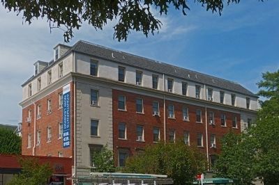
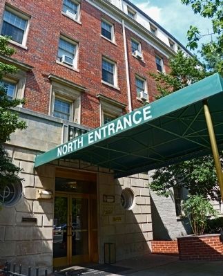
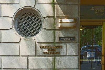
In 1920 the house was razed, and 125,000 tons of dirt and rock were removed to lower the plot to the level of Connecticut Avenue. Harry Wardman used eight acres to build Cathedral Mansions here, a complex of three buildings containing 500 apartments - a the time said to be the largest apartment complex south of New York.
Erected by Cultural Tourism DC.
Topics and series. This historical marker is listed in these topic lists: Parks & Recreational Areas • Settlements & Settlers • War, US Civil. In addition, it is included in the DC, Art on Call, and the Former U.S. Presidents: #15 James Buchanan series lists. A significant historical year for this entry is 1819.
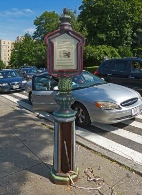
Location. 38° 55.783′ N, 77° 3.317′ W. Marker is in Northwest Washington in Washington, District of Columbia. It is in Woodley Park. Marker is on Connecticut Avenue Northwest, 0.1 miles south of Devonshire Place Northwest, on the right when traveling south. Marker is in an old police call-box in front of Cathedral Mansions Apartments west of the National Zoo. Touch for map. Marker is at or near this postal address: 3000 Connecticut Avenue Northwest, Washington DC 20008, United States of America. Touch for directions.
Other nearby markers. At least 8 other markers are within walking distance of this marker. Anup Joshi (about 400 feet away, measured in a direct line); Conservation Geography (about 400 feet away); Fishing Cat (about 400 feet away); Sloth Bear (about 400 feet away); Saving Species Through Science (about 500 feet away); Max Kampelman (about 500 feet away); Long & Winding Woodley Road (about 500 feet away); Optimism for the Oryx (about 600 feet away). Touch for a list and map of all markers in Northwest Washington.
Credits. This page was last revised on January 30, 2023. It was originally submitted on August 18, 2013, by Allen C. Browne of Silver Spring, Maryland. This page has been viewed 554 times since then and 10 times this year. Photos: 1, 2, 3, 4, 5, 6. submitted on August 18, 2013, by Allen C. Browne of Silver Spring, Maryland. • Bernard Fisher was the editor who published this page.
