Burnside in Pulaski County, Kentucky — The American South (East South Central)
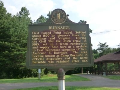
Burnside
Erected 1966 by Kentucky Historical Society, Kentucky Department of Highways. (Marker Number 980.)
Topics and series. This historical marker is listed in this topic list: War, US Civil. In addition, it is included in the Kentucky Historical Society series list. A significant historical year for this entry is 1800.
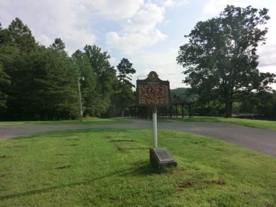
Location. 36° 58.542′ N, 84° 35.869′ W. Marker is in Burnside, Kentucky, in Pulaski County. Marker can be reached from Main Street (U.S. 27) south of West Lakeshore Drive, on the right when traveling south. Located in General Burnside State Park. Touch for map. Marker is at or near this postal address: 8801 S Hwy 27, Burnside KY 42519, United States of America. Touch for directions.
Other nearby markers. At least 8 other markers are within 9 miles of this marker, measured as the crow flies. Old Burnside / Harriette Simpson Arnow (approx. 0.8 miles away); First Boy Scout Troop (approx. one mile away); Harriette Simpson Arnow (approx. 1.2 miles away); Pulaski County 1799 (approx. 7.9 miles away); Town Spring (approx. 7.9 miles away); Morgan's First Raid (approx. 8.1 miles away); Home of Governor Morrow (approx. 8.3 miles away); Russell S. Dyche Memorial Highway (approx. 8.4 miles away). Touch for a list and map of all markers in Burnside.

Photographed By Don Morfe, July 22, 2013
2. Burnside Marker
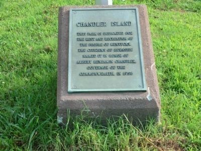
(This plaque is at the base of the Burnside marker)
Chandler Island-This park is dedicated for the rest and recreation of the people of Kentucky, the citizens of Burnside, named it in honor of Albert Benjamin Chandler, Governor of the Commonwealth, in 1958.
Credits. This page was last revised on June 16, 2016. It was originally submitted on August 19, 2013, by Don Morfe of Baltimore, Maryland. This page has been viewed 599 times since then and 30 times this year. Photos: 1, 2, 3. submitted on August 19, 2013, by Don Morfe of Baltimore, Maryland. • Bernard Fisher was the editor who published this page.

