Lovelock in Pershing County, Nevada — The American Mountains (Southwest)
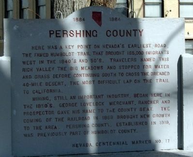
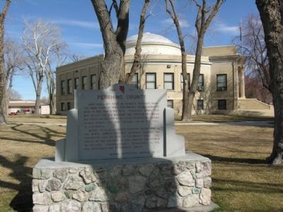
Pershing County
Mining, still an important industry, began here in the 1850's. George Lovelock merchant, rancher and prospector gave his name to the county seat. The coming of the railroad in 1869 brought new growth to the area. Pershing County, established in 1919, was previously part of Humboldt County.
Erected 1964. (Marker Number 17.)
Topics. This historical marker is listed in this topic list: Settlements & Settlers. A significant historical year for this entry is 1869.
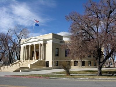
Location. 40° 10.825′ N, 118° 28.596′ W. Marker is in Lovelock, Nevada, in Pershing County. Marker can be reached from the intersection of Central Avenue and Western Avenue, on the right when traveling south. Marker is located south of the main entrance to the Pershing County Courthouse. Touch for map. Marker is in this post office area: Lovelock NV 89419, United States of America. Touch for directions.
Other nearby markers. At least 8 other markers are within walking distance of this marker. Pershing County Court House (within shouting distance of this marker); Dedicated to the Memory of Karl O. Olfers (approx. 0.2 miles away); The Ice House (approx. 0.2 miles away); Applegate-Lassen Emigrant Trail (approx. ¾ mile away); Seven Troughs Mining District (approx. ¾ mile away); The Marzen House (approx. ¾ mile away); La' Belle Brothel 1961-1981 (approx. ¾ mile away); Mazuma (approx. ¾ mile away). Touch for a list and map of all markers in Lovelock.
More about this marker. The marker is Nevada Centennial Marker No. 17, installed in 1964 as part of Nevada's celebration of its 100th anniversary of statehood and the beginning of the Nevada Historical Marker Program.
Also see . . . New Amended Text for Marker. The Nevada State Historic Preservation Office (SHPO) recently updated the text of the roughly 260 state historical markers in Nevada. The Nevada SHPO placed the amended text of each individual marker on its website and will change the actual markers in the field as funding allows. Minor changes have been made to the marker for grammar and readability. In regards to content, the marker has been amended to remove the wording that mining is still an important industry. The link will take you to the Nevada SHPO page for the marker with the amended text. (Submitted on November 12, 2013, by Duane Hall of Abilene, Texas.)
Credits. This page was last revised on June 16, 2016. It was originally submitted on August 19, 2013, by Duane Hall of Abilene, Texas. This page has been viewed 486 times since then and 19 times this year. Photos: 1, 2, 3. submitted on August 19, 2013, by Duane Hall of Abilene, Texas.


