Point of Rocks in Sweetwater County, Wyoming — The American West (Mountains)
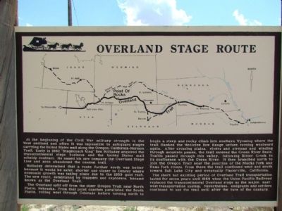
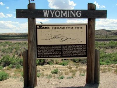
Overland Stage Route
At the beginning of the Civil War military strength in the West declined and often it was impossible to safeguard stages carrying the United States mail along the Oregon-California-Mormon Trail. Early in 1862 "Stagecoach King" Ben Holladay acquired the transcontinental stage business and the United States mail subsidy contract. He named his new company the Overland Stage Line and soon abandoned the central trail.
Holladay determined that a route further south was better because it would be safer, shorter and closer to Denver where economic growth was taking place due to the 1859 gold rush. The new route, established by trappers and explorers, became known as the Overland Trail.
The Overland split off from the older Oregon Trail near North Platte, Nebraska. From that point coaches paralleled the South Platte, rolling west through Colorado before turning north to begin a steep and rocky climb into southern Wyoming where the trail flanked the Medicine Bow Range before turning westward again. After crossing plains, rivers and streams and winding through mountain passes, the trail entered the Green River Basin. Traffic passed through this valley, following Bitter Creek to its confluence with the Green River. It then branched north to join the Oregon Trail near the junction of the Blacks Fork and Hams Fork rivers. From there the trail continued west and south toward Salt Lake City and eventually Placerville, California.
The short but exciting period of Overland Trail transportation lasted for seven years until 1869 when the Union Pacific Railroad replaced the transcontinental Overland stage as the major, east-west transportation system. Nevertheless, emigrants and settlers continued to use the trail until after the turn of the century.
Topics and series. This historical marker is listed in this topic list: Roads & Vehicles. In addition, it is included in the Overland Trail series list. A significant historical year for this entry is 1862.
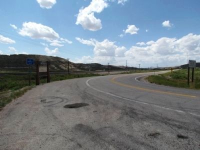
Location. 41° 40.656′ N, 108° 46.975′ W. Marker is in Point of Rocks, Wyoming, in Sweetwater County. Marker is on I-80 Service Road South, on the left when traveling west. Marker can be reached by exiting I-80 at Exit 130 and driving south. Touch for map. Marker is in this post office area: Point of Rocks WY 82942, United States of America. Touch for directions.
Other nearby markers. At least 8 other markers are within 12 miles of this marker, measured as the crow flies. Almond Overland Stage Station (about 700 feet away, measured in a direct line); Point of Rocks Stage Station (approx. 0.4 miles away); Point of Rocks (approx. 0.6 miles away); An Unsolved Mystery (approx. 0.6 miles away); Immigrants (approx. 11.2 miles away); Working in the Mines (approx. 11.2 miles away); Town Development (approx. 11.2 miles away); Opening the Mines (approx. 11.2 miles away). Touch for a list and map of all markers in Point of Rocks.
Also see . . . Overland Stage - From Wyoming Tales and Trails. (Submitted on August 20, 2013, by Duane Hall of Abilene, Texas.)
Credits. This page was last revised on June 16, 2016. It was originally submitted on August 20, 2013, by Duane Hall of Abilene, Texas. This page has been viewed 913 times since then and 58 times this year. Photos: 1, 2, 3, 4. submitted on August 20, 2013, by Duane Hall of Abilene, Texas.


