Wetumpka in Elmore County, Alabama — The American South (East South Central)
Wetumpka Historical Marker
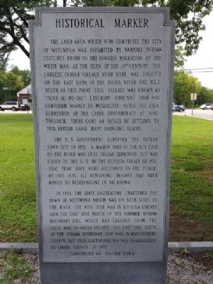
The land area which now comprises the City of Wetumpka was inhabited by various Indian cultures prior to the inward migration of the white man at the turn of the 19th century. The largest Indian village near here was located on the east bank of the Coosa River one mile south of this point. This village was known as “Oche-au-po-fau” (Hickory Ground) and was composed mainly of Muscogees. After the 1814 surrender of the Creek Confederacy at Fort Toulouse, there came an influx of settlers to this fertile land, many bringing slaves.
The U.S. Government surveyed the future town site in 1831. A major part of the site east of the river was still Indian Territory, but was ceded to the U.S. by the Cusseta Treaty of 1832. That year lots were auctioned to the public. By late 1836, all remaining Indians had been moved to reservations in Oklahoma.
In 1834, the state legislature chartered the town of Wetumpka, which was on both sides of the river, the west side was in Autauga county, and the east side north of the former Indian boundary line, which ran easterly from the falls, was in Coosa County. The east side south of the Indian boundary line was in Montgomery County, but this latter portion was transferred to Coosa County in 1837.
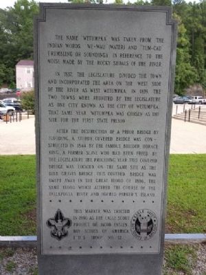
The name “Wetumpka” was taken from the Indian words “We-Wau” (water) and “Tum-cau” (rumbling or sounding), in reference to the noise made by the rocky shoals of the river.
In 1837, the legislature divided the town and incorporated the area on the west side of the river as West Wetumpka. In 1839, the two towns were reunited by the legislature as one city known as the city of Wetumpka. That same year, Wetumpka was chosen as the site for the first state prison.
After the destruction of a prior bridge by flooding, a sturdy, covered bridge was constructed in 1844 by a famous builder, Horace King, a former slave who had been freed by the legislature the preceding year. This covered bridge was located on the same site as the Bibb Graves Bridge. This covered bridge was swept away in the great flood of 1886, the same flood that altered the course of the Tallapoosa River and formed Parker's Island.
Erected 1990 by Eagle Scout Project of Jacob Enslen Boy Scouts of America Troop 52.
Topics. This historical marker is listed in these topic lists: Bridges & Viaducts • Native Americans • Settlements & Settlers. A significant historical year for this entry is 1814.
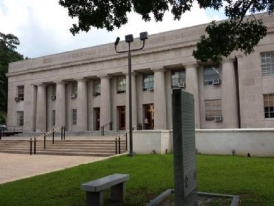
Location. 32° 32.217′ N, 86° 12.309′ W. Marker is in Wetumpka, Alabama, in Elmore County. Marker can be reached from the intersection of East Commerce Street and Court Street, on the right when traveling east. Touch for map. Marker is at or near this postal address: 100 East Commerce Street, Wetumpka AL 36092, United States of America. Touch for directions.
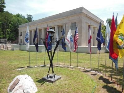
Other nearby markers. At least 8 other markers are within walking distance of this marker. Elmore County Vietnam War Memorial (a few steps from this marker); Elmore County Korean War Memorial (a few steps from this marker); Elmore County World War I Memorial (within shouting distance of this marker); Wetumpka's Bridges (about 400 feet away, measured in a direct line); High Water Mark (about 500 feet away); Old Calaboose (about 500 feet away); Wetumpka Timeline (about 600 feet away); Wetumpka Impact Crater (about 600 feet away). Touch for a list and map of all markers in Wetumpka.
Credits. This page was last revised on August 28, 2020. It was originally submitted on August 20, 2013, by Mark Hilton of Montgomery, Alabama. This page has been viewed 1,411 times since then and 52 times this year. Photos: 1, 2, 3. submitted on August 20, 2013, by Mark Hilton of Montgomery, Alabama. 4. submitted on October 18, 2013, by Cosmos Mariner of Cape Canaveral, Florida. • Bernard Fisher was the editor who published this page.


