Evanston in Uinta County, Wyoming — The American West (Mountains)
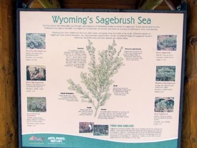
Wyoming's Sagebrush Sea
Wyoming has more sagebrush than any other state, occupying more than 50% of its lands. Different species of sagebrush have distinct elevation, soil, and moisture requirements. Of the 13 different types of sagebrush found in Wyoming, six of the most common species are shown below.
Leaves
All sagebrush species (except silver sagebrush) are evergreen. The aromatic leaves are covered with short, silver hairs—which reduce water loss and discourage insects. The leaves contain camphor and were used in traditional medicine to treat coughs, headaches, stomachaches, and fevers.
Flowers and Seeds
Sagebrush produces tiny 1/8-inch long flowers from August to September. It reproduces from seeds cast by wind onto moist soils in the winter.
Small Branches
Native Americans used smaller branches for weaving baskets and other household items.
Bark
Ute Indians wove the shredded bark into wicks for candles and made sacks of woven bark lined with grass.
Trunk
Woody part of the plant was burned for fuel and used to construct shelters.
Roots
The root system extends as much as six feet deep into the soil to access water during dry periods, and spreads widely around the plant to maximize water uptake during spring snowmelt.
Wyoming Big Sagebrush
Habitat: Dry areas with well-drained soils.
Elevation: Up to 8,000'
Height: 24-36"
Basin Big Sagebrush
Habitat: Well-drained soils, moderate precipitation.
Elevation: 3,000-7,000'
Height: 5-6'
Mountain Silver Sagebrush
Habitat: Along stream sides, edges of meadows, and snow bank areas.
Elevation: 6,000-10,000'
Height: 3-4'
Black Sagebrush
Habitat: Clay pan soils.
Elevation: 4,000-8,500'
Height: 4-12"
Mountain Big Sagebrush
Habitat: Well drained side slopes and ridges.
Elevation: 6,800-8,500'
Height: 3-4'
Alkali Sagebrush
Habitat: Dry areas where soils are alkaline and well drained.
Elevation: Up to 8,000'
Height: 10"
Food and Shelter
Sagebrush provides shelter, food, and nesting habitat for all types of wildlife including several species whose declining populations are of conservation concern. The leaves are a nutritious and essential food source for wildlife, especially during the winter. For species such as sage grouse and pronghorn, sagebrush makes up over 95% of their winter diet and 50% of the summer diet.
Erected by Wyoming State Parks & Cultural Resources.
Topics. This historical marker is listed in these topic lists: Environment • Native Americans.
Location. 41° 15.886′ N, 110° 55.995′ W. Marker is in Evanston, Wyoming, in Uinta County. Marker can be reached from Bear River Drive, 0.3 miles south of Interstate 80, on the right when traveling south. Marker is located at the Bear River State Park Travel Information Center approx. 0.3 miles south of I-80 Exit 6. Touch for map. Marker is in this post office area: Evanston WY 82931, United States of America. Touch for directions.
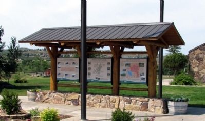
Other nearby markers. At least 8 other markers are within 2 miles of this marker, measured as the crow flies. A Path Well-Traveled (here, next to this marker); Bear River Watershed (here, next to this marker); The Wyoming State Hospital (approx. 0.9 miles away); Lincoln Highway — Sunset Cabins (approx. one mile away); Evanston (approx. 1.2 miles away); First Brick Church (approx. 1.6 miles away); Uinta County Courthouse (approx. 1.7 miles away); Evanston Downtown Historic District (approx. 1.7 miles away). Touch for a list and map of all markers in Evanston.
Credits. This page was last revised on June 16, 2016. It was originally submitted on August 21, 2013, by Duane Hall of Abilene, Texas. This page has been viewed 541 times since then and 17 times this year. Photos: 1. submitted on August 21, 2013, by Duane Hall of Abilene, Texas. 2, 3. submitted on August 16, 2013, by Duane Hall of Abilene, Texas.


