Wagoner in Wagoner County, Oklahoma — The American South (West South Central)
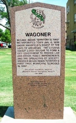
Wagoner
Became Indian Territory's first incorporated town Jan. 4, 1896 under Mansfield's Digest of the Laws of Arkansas. The citizens (about 2,000) sought to form a city government to provide improvements and the upbuilding of society. Wagoner began Indian Territory's first free municipal schools in 1897.
Erected 1996 by Oklahoma Historical Society and Wagoner County Historical Society. (Marker Number 226.)
Topics and series. This historical marker is listed in these topic lists: Education • Settlements & Settlers. In addition, it is included in the Oklahoma Historical Society series list. A significant historical month for this entry is January 1843.
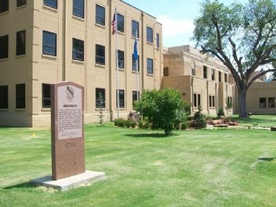
Location. 35° 57.59′ N, 95° 22.491′ W. Marker is in Wagoner, Oklahoma, in Wagoner County. Marker is at the intersection of Cherokee Street (State Highway 51) and Casaver Avenue, on the left when traveling east on Cherokee Street. Marker is on the southwest grounds of the county courthouse. Touch for map. Marker is at or near this postal address: 307 East Cherokee Street, Wagoner OK 74467, United States of America. Touch for directions.
Other nearby markers. At least 8 other markers are within 9 miles of this marker, measured as the crow flies. World War II Memorial (here, next to this marker); Melvin "Buck" Garrison (within shouting distance of this marker); Sam Powell and U.S. Court (within shouting distance of this marker); Wagoner County Veterans Memorial (within shouting distance of this marker); Old City Hall & Fire Station (about 700 feet away, measured in a direct line); Oklahoma Centennial Bench (about 800 feet away); Semore Park (approx. 0.2 miles away); Texas Road (approx. 8.8 miles away). Touch for a list and map of all markers in Wagoner.
Also see . . . History of Wagoner County, Oklahoma. (Submitted on August 24, 2013, by William Fischer, Jr. of Scranton, Pennsylvania.)
Credits. This page was last revised on September 29, 2020. It was originally submitted on August 24, 2013, by William Fischer, Jr. of Scranton, Pennsylvania. This page has been viewed 403 times since then and 24 times this year. Photos: 1, 2. submitted on August 24, 2013, by William Fischer, Jr. of Scranton, Pennsylvania.

