Wagoner in Wagoner County, Oklahoma — The American South (West South Central)
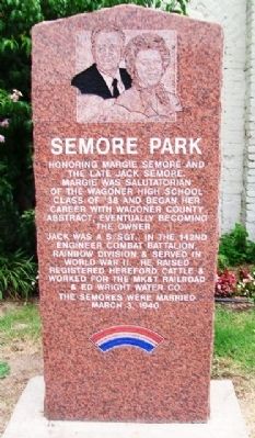
Semore Park
Honoring Margie Semore and the late Jack Semore.
Margie was Salutatorian of the Wagoner High School Class of '38 and began her career with Wagoner County Abstract, eventually becoming the owner.
Jack was a S/Sgt., in the 142nd Engineer Combat Battalion, Rainbow Division & served in World War II. He raised registered Hereford cattle & worked for the MK&T Railroad & Ed Wright Water Co.
The Semores were married March 3, 1940
Erected by City of Wagoner.
Topics. This historical marker is listed in these topic lists: Industry & Commerce • Patriots & Patriotism • War, World II. A significant historical date for this entry is March 3, 1907.
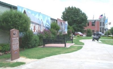
Location. 35° 57.603′ N, 95° 22.653′ W. Marker is in Wagoner, Oklahoma, in Wagoner County. Marker is at the intersection of Cherokee Street (State Highway 51) and Main Street, on the right when traveling west on Cherokee Street. Touch for map. Marker is in this post office area: Wagoner OK 74467, United States of America. Touch for directions.
Other nearby markers. At least 8 other markers are within 9 miles of this marker, measured as the crow flies. Oklahoma Centennial Bench (a few steps from this marker); Old City Hall & Fire Station (a few steps from this marker); World War II Memorial (about 800 feet away, measured in a direct line); Wagoner (approx. 0.2 miles away); Melvin "Buck" Garrison (approx. 0.2 miles away); Sam Powell and U.S. Court (approx. 0.2 miles away); Wagoner County Veterans Memorial (approx. 0.2 miles away); Texas Road (approx. 8.9 miles away). Touch for a list and map of all markers in Wagoner.
Credits. This page was last revised on June 16, 2016. It was originally submitted on August 24, 2013, by William Fischer, Jr. of Scranton, Pennsylvania. This page has been viewed 422 times since then and 13 times this year. Photos: 1, 2. submitted on August 24, 2013, by William Fischer, Jr. of Scranton, Pennsylvania.

