Near Sonora in Tuolumne County, California — The American West (Pacific Coastal)
Shaw’s Flat
Mark Twain Bret Harte Trail
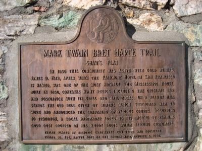
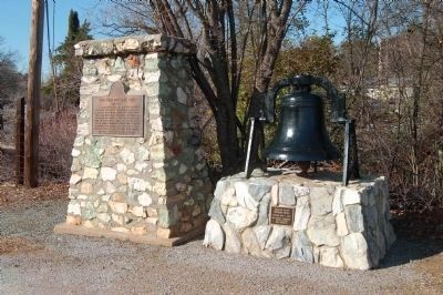
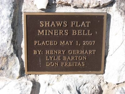
In 1850 this community was alive with gold miners. James D. Fair, after whom the Fairmont Hotel in San Francisco is named, was one of the most notable. The Mississippi House, built in 1850, contains many relics including the original bar and postoffice with its grill and mail boxes. On a nearby hill stands the old bell given by miners which summoned men to work and announced the governing of various courts. According to tradition, a local bartender added to his income by panning gold dust dropped on his muddy boots while serving customers.
Erected 1947 by Historic Landmark Committee and Tuolumne Parlor No. 144, Native Sons of the Golden West. (Marker Number 395.)
Topics and series. This historical marker is listed in these topic lists: Notable Places • Settlements & Settlers. In addition, it is included in the California Historical Landmarks, the Mark Twain Bret Harte Trail, and the Native Sons/Daughters of the Golden West series lists. A significant historical year for this entry is 1850.
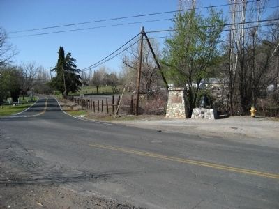
Location. 38° 0.226′ N, 120° 24.088′ W. Marker is near Sonora, California, in Tuolumne County. Marker is at the intersection of Shaw's Flat Road and Mt Brow Road, on the left when traveling south on Shaw's Flat Road. 0.6 miles south of Highway 49. Touch for map. Marker is in this post office area: Sonora CA 95370, United States of America. Touch for directions.
Other nearby markers. At least 8 other markers are within 2 miles of this marker, measured as the crow flies. Columbia (approx. 0.7 miles away); Bonanza Mine (approx. 1.3 miles away); Springfield (approx. 1.4 miles away); Rother's Corner (approx. 1˝ miles away); Springfield Cemetery (approx. 1˝ miles away); Sonora IOOF Lodge No. 10 (approx. 1˝ miles away); -Yo- Semite House (approx. 1.6 miles away); Original Site of the Sonora Daily (approx. 1.6 miles away). Touch for a list and map of all markers in Sonora.
More about this marker. Located between Mt. Brow Road and Shaw’s Flat School Road.
Regarding Shaw’s Flat. In 1948 this was designated California Historical Landmark No. 395 - Shaw's Flat.
Credits. This page was last revised on January 28, 2024. It was originally submitted on April 1, 2008, by Richard Wisehart of Sonora, California. This page has been viewed 1,784 times since then and 26 times this year. Photos: 1. submitted on April 1, 2008, by Richard Wisehart of Sonora, California. 2. submitted on March 7, 2012, by Barry Swackhamer of Brentwood, California. 3, 4. submitted on April 1, 2008, by Richard Wisehart of Sonora, California. • J. J. Prats was the editor who published this page.


