Marker Logo HMdb.org THE HISTORICAL
MARKER DATABASE
“Bite-Size Bits of Local, National, and Global History”
El Paso in El Paso County, Texas — The American South (West South Central)
 

Old San Francisco Historic District


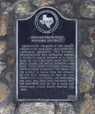
Old San Francisco Historic District Marker image. Click for full size.
Photographed By PaulwC3, July 19, 2013
1. Old San Francisco Historic District Marker
Inscription. Composed primarily of early twentieth-century residential apartment buildings, this historic neighborhood was developed during a period of major growth in El Paso. Most of the structures were built of brick, stone, or wood between 1908 and 1923 and feature similar architectural elements. The name of the district is taken from the likeness of the hilly terrain to that of San Francisco, California. In addition, the area was developed on what was the northern side of the El Paso - San Francisco Stage Route during the 1800s.
 
Erected 1984 by Texas Historical Commission. (Marker Number 3805.)
 
Topics. This historical marker is listed in these topic lists: ArchitectureRoads & VehiclesSettlements & Settlers. A significant historical year for this entry is 1908.
 
Location. 31° 45.552′ N, 106° 29.73′ W. Marker is in El Paso, Texas, in El Paso County. Marker is at the intersection of West Missouri Avenue and North Coldwell Street, on the right when traveling south on West Missouri Avenue. The marker is located in the Grace Chope Park. Touch for map. Marker is at or near this postal address: 535 West Missouri Avenue, El Paso TX 79901, United States of America. Touch for directions.
 
Other nearby markers. At least 8 other markers are within walking distance of this marker. El Paso Union Passenger Station (about 700 feet away, measured in a direct line); Bataan Memorial Trainway
Paid Advertisement
Click on the ad for more information.
Please report objectionable advertising to the Editor.
Click or scan to see
this page online
(approx. 0.2 miles away); Burges House (approx. ¼ mile away); El Paso & Southwestern Railroad (approx. ¼ mile away); Old B'Nai Zion Synagogue (approx. 0.3 miles away); Hotel Paso Del Norte (approx. 0.4 miles away); A City Is Born (approx. 0.4 miles away); El Paso (approx. 0.4 miles away). Touch for a list and map of all markers in El Paso.
 
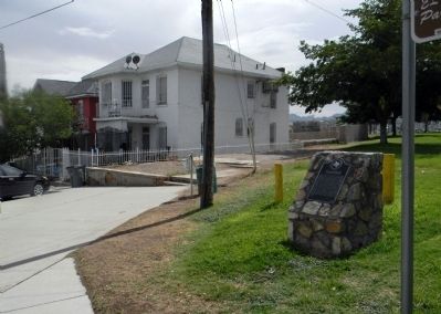
Wide view of the Old San Francisco Historic District Marker image. Click for full size.
Photographed By PaulwC3, July 19, 2013
2. Wide view of the Old San Francisco Historic District Marker
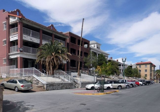
Buildings of the Old San Francisco Historic District image. Click for full size.
Photographed By PaulwC3, July 19, 2013
3. Buildings of the Old San Francisco Historic District
 
 
Credits. This page was last revised on January 9, 2020. It was originally submitted on August 28, 2013, by PaulwC3 of Northern, Virginia. This page has been viewed 848 times since then and 55 times this year. Photos:   1, 2, 3. submitted on August 28, 2013, by PaulwC3 of Northern, Virginia.
Share this page.  
Share on Tumblr
m=68168

CeraNet Cloud Computing sponsors the Historical Marker Database.
This website earns income from purchases you make after using our links to Amazon.com. We appreciate your support.
Paid Advertisement
Apr. 16, 2024