Kenosha in Kenosha County, Wisconsin — The American Midwest (Great Lakes)
Operations Desert Shield / Storm Memorial
August 7, 1990 - February 28, 1991
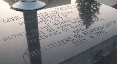
Inscription.
Operations
Desert Shield / Storm
Dedicated by
D. I. M. E. S.
Duties in the Middle East Support
Coat of Arms Post 2751
Veterans of Foreign Wars,
and
the Citizens of Kenosha County
July 4, 1992
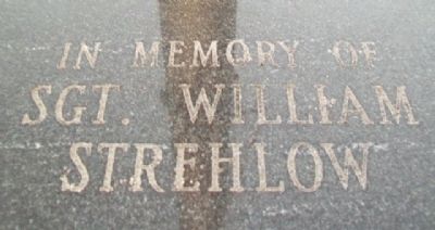
In memory of
Sgt. William Strehlow
Erected 1992 by VFW Post 2751 and the Citizens of Kenosha County.
Topics. This memorial is listed in these topic lists: Fraternal or Sororal Organizations • Patriots & Patriotism • War, 1st Iraq & Desert Storm.
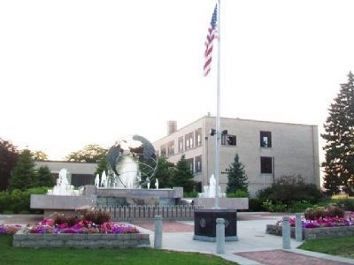
Location. 42° 35.258′ N, 87° 49.168′ W. Marker is in Kenosha, Wisconsin, in Kenosha County. Memorial is at the intersection of 6th Avenue and 52nd Street, on the right when traveling south on 6th Avenue. Marker is in Navy Memorial Park. Touch for map. Marker is in this post office area: Kenosha WI 53140, United States of America. Touch for directions.
Other nearby markers. At least 8 other markers are within walking distance of this marker. Veterans Memorial Fountain (a few steps from this marker); Korean War Memorial (a few steps from this marker); War Memorial (within shouting distance of this marker); The United States Marine Corps (within shouting distance of this marker); Naval Memorial (within shouting distance of this marker); Remember Pearl Harbor (within shouting distance of this marker); Kenosha (Southport) Lighthouse (approx. 0.2 miles away); Kenosha County Courthouse (approx. ¼ mile away). Touch for a list and map of all markers in Kenosha.
Credits. This page was last revised on June 16, 2016. It was originally submitted on September 10, 2013, by William Fischer, Jr. of Scranton, Pennsylvania. This page has been viewed 592 times since then and 11 times this year. Photos: 1, 2, 3. submitted on September 10, 2013, by William Fischer, Jr. of Scranton, Pennsylvania.


