Marker Logo HMdb.org THE HISTORICAL
MARKER DATABASE
“Bite-Size Bits of Local, National, and Global History”
Vicksburg in Kalamazoo County, Michigan — The American Midwest (Great Lakes)
 

Vickers' Mill


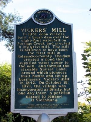
Vickers' Mill Marker image. Click for full size.
Photographed By Duane Hall, September 17, 2013
1. Vickers' Mill Marker
Inscription. In 1831, John Vickers built a brush dam over the eight-foot waterfall on Portage Creek and erected a log grist mill. The mill is believed to have been the first mill in Kalamazoo County. The dam created a pond that supplied water power to the mill, and formed the sizeable Sunset Lake, around which pioneers built homes and set up businesses. Vickers died in 1842. On October 18, 1871, the village was incorporated as Brady, but one day later, a petition passed to rename it Vicksburg.
 
Erected 2001 by Michigan Historical Center, Michigan Department of State. (Marker Number L2086C.)
 
Topics and series. This historical marker is listed in these topic lists: Industry & CommerceSettlements & Settlers. In addition, it is included in the Michigan Historical Commission series list. A significant historical month for this entry is October 1812.
 
Location. 42° 7.196′ N, 85° 32.069′ W. Marker is in Vicksburg, Michigan, in Kalamazoo County. Marker is at the intersection of W. Prairie Street and S. Michigan Avenue, on the left when traveling west on W. Prairie Street. Marker is located at the north end of Clark Park. Touch for map. Marker is at or near this postal address: 215 W Prairie Street, Vicksburg MI 49097, United States of America. Touch for directions.
 
Other nearby markers. At least 8 other markers are within 7 miles of this marker, measured as the crow flies. Vicksburg's First Mill (about 700 feet away,
Paid Advertisement
Click on the ad for more information.
Please report objectionable advertising to the Editor.
Click or scan to see
this page online
measured in a direct line); Fanny M. Bair Library (approx. 0.2 miles away); Underground Railroad House (approx. 4.9 miles away); Schoolcraft G.A.R. Memorial (approx. 5.3 miles away); Central Cemetery Veterans Memorial (approx. 6˝ miles away); Hayloft Theatre (approx. 6.7 miles away); Stuart Manor (approx. 6.7 miles away); Portage District No. 8 School (approx. 6.7 miles away). Touch for a list and map of all markers in Vicksburg.
 
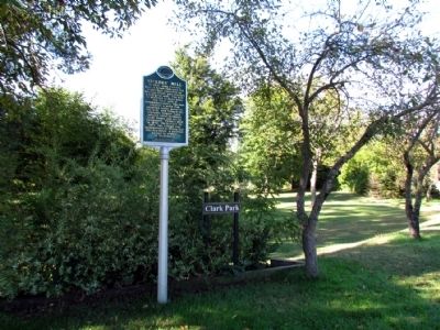
Vickers' Mill Marker image. Click for full size.
Photographed By Duane Hall, September 17, 2013
2. Vickers' Mill Marker
At north end of Clark Park
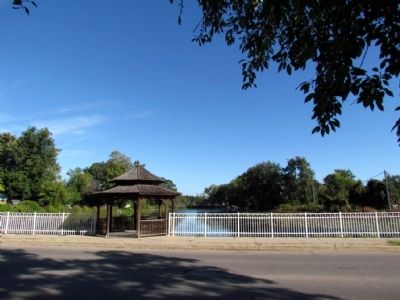
East Arm of Sunset Lake image. Click for full size.
Photographed By Duane Hall, September 17, 2013
3. East Arm of Sunset Lake
View from marker to the north across W. Prairie St
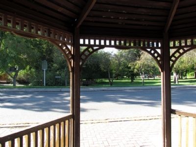
Vickers' Mill Marker in Clark Park image. Click for full size.
Photographed By Duane Hall, September 17, 2013
4. Vickers' Mill Marker in Clark Park
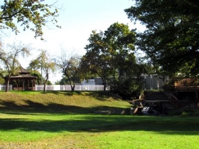
Vickers' Mill Marker image. Click for full size.
Photographed By Duane Hall, September 17, 2013
5. Vickers' Mill Marker
View to north from Clark Park
 
 
Credits. This page was last revised on June 16, 2016. It was originally submitted on September 24, 2013, by Duane Hall of Abilene, Texas. This page has been viewed 451 times since then and 19 times this year. Photos:   1, 2, 3, 4, 5. submitted on September 24, 2013, by Duane Hall of Abilene, Texas.
Share this page.  
Share on Tumblr
m=68794

CeraNet Cloud Computing sponsors the Historical Marker Database.
This website earns income from purchases you make after using our links to Amazon.com. We appreciate your support.
Paid Advertisement
Apr. 19, 2024