Near Sharpsburg in Washington County, Maryland — The American Northeast (Mid-Atlantic)
125th Penna
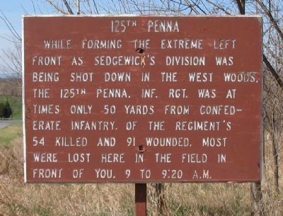
Inscription.
While forming the extreme left front as Sedgewick's Division was being shot down in the West Woods, the 125th Penna. Inf. Rgt. was at times only 50 yards from Confederate Infantry. Of the Regiment's 54 killed and 91 wounded, most were lost here in the field in front of you. 9 to 9:20 a.m.
Topics. This historical marker is listed in this topic list: War, US Civil.
Location. 39° 28.515′ N, 77° 44.889′ W. Marker is near Sharpsburg, Maryland, in Washington County. Marker is on Smoketown Road, on the right when traveling west. Touch for map. Marker is in this post office area: Sharpsburg MD 21782, United States of America. Touch for directions.
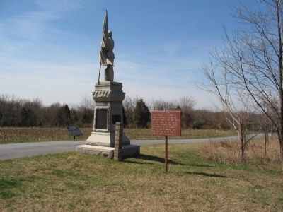
Other nearby markers. At least 8 other markers are within walking distance of this marker. 125th Pennsylvania Volunteer Infantry (here, next to this marker); Purnell Legion Infantry (a few steps from this marker); Longstreet's Command (a few steps from this marker); 34th New York Infantry (a few steps from this marker); Walker's Division, Longstreet's Command (a few steps from this marker); Jackson's Command (about 400 feet away, measured in a direct line); Dunker Church - "Symbol of Peace and Brotherhood" (about 400 feet away); Beacon of Peace (about 400 feet away). Touch for a list and map of all markers in Sharpsburg.
Regarding 125th Penna. Col. Higgins' official report aptly explains the regiments position, and illustrates some of the confusion: "...I again advanced a short distance in the woods, and halted again to examine the enemy's position. I found him in force in my front and on my right. On looking around I discovered myself without support either in my rear or right, and, being the only mounted officer present, I gave my horse to Lieutenant Higgins, and instructed him to ride back to the general, inform him of my situation, and ask him to send me support immediately, or I would be unable to hold my position, and that the enemy would certainly flank me and cut me off, my command being at this time in advance of the whole corps." (Submitted on April 5, 2008, by Craig Swain of Leesburg, Virginia.)
Also see . . . Antietam Battlefield. National Park Service site. (Submitted on April 5, 2008, by Craig Swain of Leesburg, Virginia.)

Photographed By Craig Swain, March 29, 2008
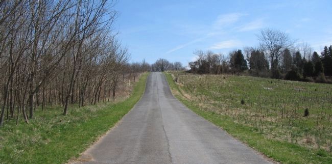
3. The 125th Pennsylvania Position
Looking east from the far end of the Smoketown Road extension. The regiment occupied a position on the high ground on the north side (left) of the road in the distance. While tactically a formidable position, if properly supported, the flank here was in the air and easily turned. At the time of the battle, this area that is now open field was part of the West Woods. Union commanders could not see the peril due to the heavy woods, confusion of battle, and conflicting reports. The position of the 125th is an example of the confusion. Most of the regiment's parent brigade were posted in the East Woods at this time.
Credits. This page was last revised on September 21, 2017. It was originally submitted on April 5, 2008, by Craig Swain of Leesburg, Virginia. This page has been viewed 1,001 times since then and 10 times this year. Photos: 1, 2, 3. submitted on April 5, 2008, by Craig Swain of Leesburg, Virginia.

