Near Van Wert in Van Wert County, Ohio — The American Midwest (Great Lakes)
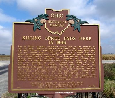
Killing Spree Ends Here in 1948
Erected 1998 by Fraternal Order of Police Lodge No. 62, Van Wert County Historical Society, and the Ohio Historical Society. (Marker Number 2-81.)
Topics and series. This historical marker is listed in this topic list: Notable Events. In addition, it is included in the Ohio Historical Society / The Ohio History Connection series list. A significant historical month for this entry is January 1866.
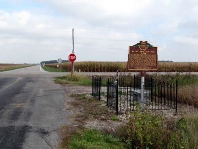
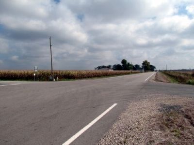
Location. 40° 55.903′ N, 84° 28.552′ W. Marker is near Van Wert, Ohio, in Van Wert County. Marker is at the intersection of Stemen Road and U.S. 224, on the right when traveling north on Stemen Road. Marker is located at the southeast corner of the intersection of Stemen Road, US 224, and State Route 637. Touch for map. Marker is in this post office area: Van Wert OH 45891, United States of America. Touch for directions.
Other nearby markers. At least 8 other markers are within 7 miles of this marker, measured as the crow flies. Ridge Township Cemetery Veterans Memorial (approx. 3.7 miles away); Grover Hill Town Hall Bell (approx. 6 miles away); The Homestead (approx. 6.3 miles away); International 2-Row Beet Lifter (approx. 6.7 miles away); Van Wert (approx. 6.7 miles away); a different marker also named Van Wert (approx. 6.7 miles away); The Barn (approx. 6.8 miles away); Lincoln Highway Tourist Cabin (approx. 6.8 miles away). Touch for a list and map of all markers in Van Wert.
Regarding Killing Spree Ends Here in 1948. From Pages 28 and 29 of the Ohio State Highway Patrol History, 75th Anniversary 1933-2008:
"In July 1948, former convicts Robert M. Daniels and John C. West murdered John E. Niebel,
a farm manager at the Mansfield Reformatory, and his wife and daughter. Both Daniels and West already had other charges against them and were on the run from lawmen.
The duo stole a vehicle and fled to Cleveland, then decided the next day to escape to Indiana. They headed west for a couple of days after the Niebel family murders, stealing another vehicle. This theft resulted in two more murders – a motorist and a truck driver.
Officials finally realized that West and Daniels still were near the Ohio-Indiana border and immediately put into effect the Patrol’s blockade plan. All posts in District A were instructed by telephone to put blockade plans M16 (Maumee River) and M15 (Sandusky River) into effect. Patrol officials also alerted local police departments.
Van Wert County Sheriff Roy Shaffer, Van Wert City Police Department Sergeant L.D. Conn and a state conservation officer were at a checkpoint when West drove up in a stolen vehicle. Sheriff Shaffer became suspicious while questioning West. Shaffer climbed on top of the vehicle, discovered Daniels and ordered him out at gun point.
West tried to run and opened fire, wounding a Lima officer and the state conservation officer, but the Lima policeman returned fire and shot West, who died two hours later. Officials captured Daniels without incident. The wounded officers later recovered."
Credits. This page was last revised on July 19, 2021. It was originally submitted on October 5, 2013, by Duane Hall of Abilene, Texas. This page has been viewed 3,207 times since then and 237 times this year. Photos: 1, 2, 3. submitted on October 5, 2013, by Duane Hall of Abilene, Texas.


