Near Corinne in Box Elder County, Utah — The American Mountains (Southwest)
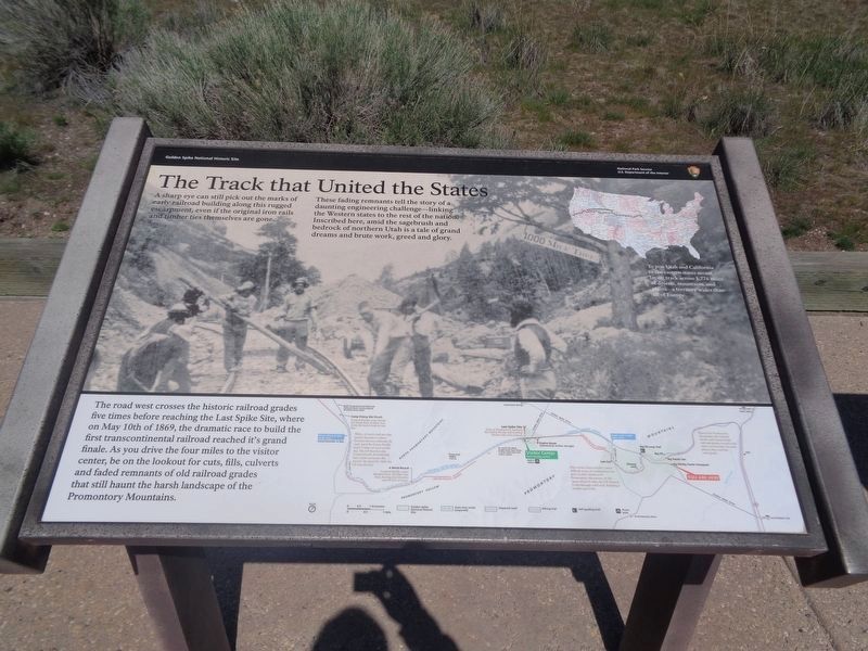
The Track that United the States
Golden Spike National Historic Site
These fading remnants tell the story of a daunting engineering challenge—linking the Western states to the rest of the nation. Inscribed here, amid the sagebrush and bedrock of northern Utah is a tale of grand dreams and brute work, greed and glory.
(US Map Caption)
To join Utah and California to the eastern states meant laying track across 1,776 miles of deserts, mountains, and plains—a territory wider than all of Europe.
(Golden Spike NHS Map Caption)
The road west crosses old railroad grades five times before reaching the Last Spike Site, where the 1869 race to build the first transcontinental railroad ended. As you drive the five miles to the visitor center, keep looking for cuts, fills, and culverts alien to these open rangelands.
Erected by National Park Service.
Topics and series. This historical marker is listed in this topic list: Railroads & Streetcars. In addition, it is included in the Transcontinental Railroad series list. A significant historical year for this entry is 1869.
Location. 41° 38.367′ N, 112° 28.45′ W. Marker is near Corinne, Utah, in Box Elder County. Marker is on West Golden Spike Drive, 0.6 miles east of N East Promontory Road (County Road W 7200N), on the right when traveling west. Marker is located near the east entrance into Golden Spike National Historical Park. Touch for map. Marker is at or near this postal address: W Golden Spike Dr, Corinne UT 84307, United States of America. Touch for directions.
Other nearby markers. At least 8 other markers are within 5 miles of this marker, measured as the crow flies. The Big Trestle (approx. 0.3 miles away); The Big Fill (approx. 0.3 miles away); The “Orange Special” Wreck (approx. 0.8 miles away); Big Fill Trail (approx. 0.9 miles away); Chinese Arch (approx. 1.2 miles away); The Last Cut (approx. 1.7 miles away); Irish Monument (approx. 4.2 miles away); Original Rail (approx. 4.2 miles away). Touch for a list and map of all markers in Corinne.
Also see . . .
1. Golden Spike National Historic Site. The National Park Service website. (Submitted on October 7, 2013.)
2. Big Fill - Wikipedia entry. (Submitted on October 7, 2013.)
Credits. This page was last revised on July 1, 2023. It was originally submitted on October 7, 2013, by Duane Hall of Abilene, Texas. This page has been viewed 777 times since then and 22 times this year. Photos: 1. submitted on July 1, 2023, by Jason Voigt of Glen Carbon, Illinois. 2. submitted on October 7, 2013, by Duane Hall of Abilene, Texas.

