Osawatomie in Miami County, Kansas — The American Midwest (Upper Plains)
Battle of Osawatomie
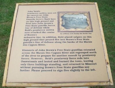
John Reid's proslavery militia men set up cannon on John Brown's Free State Guerilla force's flank here on this high ground and fired into John Brown's Free State guerilla forces line of defense while Reid's proslavery militia men attacked the center of Brown's defensive line. In addition, Reid placed snipers on this high ground that poured fire into Brown's Free State guerilla's line of defense along the banks of the Marais Des Cygnes River.
Elements of John Brown's Free State guerillas retreated across the Marais Des Cygnes River and regrouped north of the river to prepare for another assault by proslavery forces. However, Reid's proslavery force rode into Osawatomie and looted and burned the town, leaving only three buildings standing, and returned to Missouri without pursuing Brown's Free State guerillas any further. Please proceed to sign five slightly to the left.
Erected 2012 by Kansas State Historical Society. (Marker Number 4.)
Topics. This historical marker is listed in this topic list: Notable Events.
Location. 38° 30.028′ N, 94° 57.566′ W. Marker is in Osawatomie, Kansas, in Miami County. Marker is about 400 feet north of the Adair Cabin, the centerpiece of the John Brown Museum State Historic Site, in John Brown Memorial Park, with entrance off Main Street at 10th Street. Touch for map. Marker is in this post office area: Osawatomie KS 66064, United States of America. Touch for directions.
Other nearby markers. At least 8 other markers are within walking distance of this marker. A different marker also named Battle of Osawatomie (a few steps from this marker); a different marker also named Battle of Osawatomie (about 400 feet away, measured in a direct line); a different marker also named Battle of Osawatomie (about 500 feet away); a different marker also named Battle of Osawatomie (about 600 feet away); T. B. Williams and J. B. Remington (about 600 feet away); John Brown Statue (about 700 feet away); a different marker also named Battle of Osawatomie (about 700 feet away); John Brown Battleground (about 700 feet away). Touch for a list and map of all markers in Osawatomie.
Also see . . .
1. John Brown Museum State Historic Site. Kansas Historical Society website entry (Submitted on October 11, 2013, by William Fischer, Jr. of Scranton, Pennsylvania.)
2. Battle of Osawatomie Primary Documents. Internet Archive Wayback Machine website entry (Submitted on October 11, 2013, by William Fischer, Jr. of Scranton, Pennsylvania.)
Credits. This page was last revised on January 22, 2022. It was originally submitted on October 11, 2013, by William Fischer, Jr. of Scranton, Pennsylvania. This page has been viewed 411 times since then and 10 times this year. Photos: 1, 2. submitted on October 11, 2013, by William Fischer, Jr. of Scranton, Pennsylvania.

