Near Tiburon in Marin County, California — The American West (Pacific Coastal)
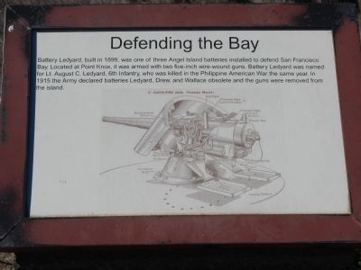
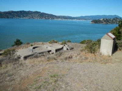
Defending the Bay
Topics. This historical marker is listed in this topic list: Forts and Castles. A significant historical year for this entry is 1899.
Location. 37° 51.404′ N, 122° 26.473′ W. Marker is near Tiburon, California, in Marin County. Marker is on Perimeter Road. Touch for map. Marker is in this post office area: Belvedere Tiburon CA 94920, United States of America. Touch for directions.
Other nearby markers. At least 8 other markers are within walking distance of this marker. The Batteries (here, next to this marker); Camp Reynolds Chapel (about 700 feet away, measured in a direct line); Mule Power (approx. 0.2 miles away); High Rank, Great View (approx. 0.2 miles away); Housing the Troops (approx. ¼ mile away); Caring for Soldiers (approx. 0.3 miles away); Camp Reynolds (approx. 0.3 miles away); Crushing Rock for the Roads (approx. 0.3 miles away). Touch for a list and map of all markers in Tiburon.
More about this marker. Perimeter Road is a 5 mile, mostly paved, walking/bicycle path that goes around Angel Island. Angel Island State Park is accessed by ferry from Tiburon.
Also see . . . Endicott Batteries - Angel Island Conservancy. In 1885 US President Grover Cleveland appointed a joint army, navy and civilian board, headed by Secretary of War William C. Endicott, known as the Board of Fortifications. The findings of the board illustrated a grim picture of existing defenses in its 1886 report and recommended a massive $127 million construction program of breech-loading cannons, mortars, floating batteries, and submarine mines for some 29 locations on the US coastline. (Submitted on October 12, 2013, by Barry Swackhamer of Brentwood, California.)
Credits. This page was last revised on June 16, 2016. It was originally submitted on October 12, 2013, by Barry Swackhamer of Brentwood, California. This page has been viewed 473 times since then and 22 times this year. Photos: 1, 2, 3. submitted on October 12, 2013, by Barry Swackhamer of Brentwood, California. • William J. Toman was the editor who published this page.


