Near Pleasanton in Linn County, Kansas — The American Midwest (Upper Plains)
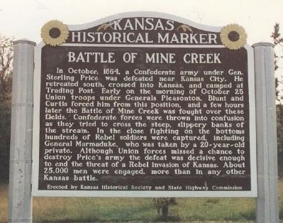
Battle of Mine Creek
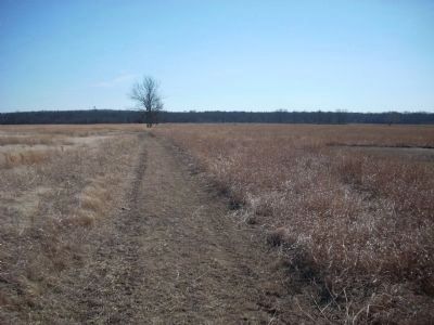
In October, 1864, a Confederate army under Gen. Stirling Price was defeated near Kansas City. He retreated south, crossed into Kansas, and camped at Trading Post. Early on the morning of October 25 Union troops under Generals Pleasonton, Blunt and Curtis forced him from this position, and a few hours later the battle of Mine Creek was fought over these fields. Confederate forces were thrown into confusion as they tried to cross the steep, slippery banks of the stream. In the close fighting on the bottoms hundreds of Rebel soldiers were captured, including General Marmaduke, who was taken by a 20-year-old private. Although Union forces missed a chance to destroy Price's army the defeat was decisive enough to end the threat of a Rebel invasion of Kansas. About 25,000 men were engaged, more than in any other Kansas battle.
Erected by Kansas Historical Society and State Highway Commission. (Marker Number 47.)
Topics and series. This historical marker is listed in this topic list: War, US Civil. In addition, it is included in the Kansas Historical Society series list. A significant historical month for this entry is October 1864.
Location. Marker has been reported missing. It was located near 38° 8′ N, 94° 42.823′ W. Marker was near Pleasanton, Kansas, in Linn County. Marker was on U.S. 69, on the right when traveling south. Marker is in a turn out approximately 2.5 miles south of Pleasonton. Touch for map. Marker was in this post office area: Pleasanton KS 66075, United States of America. Touch for directions.
Other nearby markers. At least 8 other markers are within walking distance of this location. Lieutenant Colonel Frederick W. Benteen Memorial Bridge (approx. 0.6 miles away); "Hurra for Kansas!" (approx. 0.6 miles away); Chaos at the Crossing (approx. 0.6 miles away); a different marker also named Battle of Mine Creek (approx. 0.6 miles away); Cavalry Horses (approx. ¾ mile away); Cavalry (approx. ¾ mile away); Nursing the Wounded (approx. 0.9 miles away); Conclusion of Price Campaign (approx. 0.9 miles away). Touch for a list and map of all markers in Pleasanton.
Also see . . .
1. Mine Creek Civil War Battlefield. Kansas Historical Society website entry:
This was one of the largest mounted cavalry battles in the Civil War and was the only major battle fought in Kansas. The Union brigades were commanded by Colonels Frederick W. Benteen and John F. Philips. After this battle, Federal forces pursued and defeated additional Confederates in Missouri as they attempted to return to Arkansas, Indian Territory (Oklahoma), and eventually Texas. (Submitted on April 6, 2008, by Richard E. Miller of Oxon Hill, Maryland.)
2. Battle of Mine Creek. Wikipedia entry:
a.k.a. "Battle of the Osage." (Submitted on April 6, 2008, by Richard E. Miller of Oxon Hill, Maryland.)
3. Mine Creek Battlefield. Photos of the battlefield and museum on Civil War Album. (Submitted on April 9, 2008, by Craig Swain of Leesburg, Virginia.)
Additional commentary.
1. Battle of Mine Creek Marker
The rest area where this marker originally stood has been removed. The marker is currently behind the visitor's center at Mine Creek Battlefield, hopefully however, a new rest area near the former site of the Marais Des Cygnes Massacre marker will be the home of both markers.
— Submitted June 22, 2009, by Thomas Onions of Olathe, Kansas.
Credits. This page was last revised on January 16, 2022. It was originally submitted on April 6, 2008, by Richard E. Miller of Oxon Hill, Maryland. This page has been viewed 4,386 times since then and 27 times this year. Photos: 1. submitted on April 6, 2008, by Richard E. Miller of Oxon Hill, Maryland. 2, 3. submitted on June 6, 2009, by Thomas Onions of Olathe, Kansas. 4. submitted on June 22, 2009, by Thomas Onions of Olathe, Kansas. • Craig Swain was the editor who published this page.
Editor’s want-list for this marker. • Photo of the marker and surrounding area. • Can you help?


