Victory Hills in Kansas City in Wyandotte County, Kansas — The American Midwest (Upper Plains)
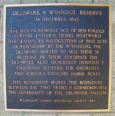
Delaware & Wyandot Reserve
14 December 1843
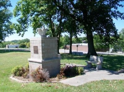
This monument marks the boundary between the two tribes & commemorates the generosity of the Delaware Nation.
——————————
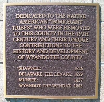
Dedicated to the Native American "Immigrant Tribes" who were removed to this county in the 19th century and their unique contributions to the history and development of Wyandotte County.
Shawnee: 1826
Delaware, the Lenape: 1829
Munsee: 1837
Wyandot, the Wendat: 1843
Topics. This historical marker is listed in these topic lists: Government & Politics • Native Americans • Peace. A significant historical year for this entry is 1830.
Location. 39° 7.316′ N, 94° 44.725′ W. Marker is in Kansas City, Kansas, in Wyandotte County. It is in Victory Hills. Marker is on College Parkway, 0.4 miles south of Parallel Parkway, on the right when traveling south. Marker is on the Kansas City Kansas Community College campus. Touch for map. Marker is in this post office area: Kansas City KS 66112, United States of America. Touch for directions.
Other nearby markers. At least 8 other markers are within 5 miles of this marker, measured as the crow flies. Grinter House (approx. 3.4 miles away); In Memory of Moses Grinter (approx. 3.4 miles away); Delaware Crossing and the Grinter Ferry (approx. 3˝ miles away); W. Eugene Smith (approx. 4.2 miles away); Gwendolyn Brooks (approx. 4.2 miles away); Aaron Douglas (approx. 4.2 miles away); Clarence D. Batchelor (approx. 4.2 miles away); Robert Merrell Gage (approx. 4.2 miles away). Touch for a list and map of all markers in Kansas City.
Also see . . .
1. "Wyandotte County" in Cutler's History of the State of Kansas (1883). Kansas Collection Books website entry (Submitted on October 16, 2013, by William Fischer, Jr. of Scranton, Pennsylvania.)
2. "The Delawares" in History of Wyandotte County Kansas (1911). KSGenWeb website entry (Submitted on October 16, 2013, by William Fischer, Jr. of Scranton, Pennsylvania.)
3. Wyandots "Come to Their Promised Land" in History of Wyandotte County Kansas (1911). KSGen Web website entry (Submitted on October 16, 2013, by William Fischer, Jr. of Scranton, Pennsylvania.)
Credits. This page was last revised on February 10, 2023. It was originally submitted on October 16, 2013, by William Fischer, Jr. of Scranton, Pennsylvania. This page has been viewed 639 times since then and 23 times this year. Photos: 1, 2, 3. submitted on October 16, 2013, by William Fischer, Jr. of Scranton, Pennsylvania.


