Darnestown in Montgomery County, Maryland — The American Northeast (Mid-Atlantic)
The Origins of Darnestown
Darnestown
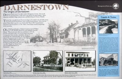
The land that eventually became Darnestown began to be settled in the mid-18th century by Scottish and Irish frontiersmen, many of whom became farmers. One of the first settlers Ninean Beall, acquired a tract of land called "Barren Hill," located between Darnestown and Germantown, in 1749. Beall, a tavern keeper, started a long lineage in the community.
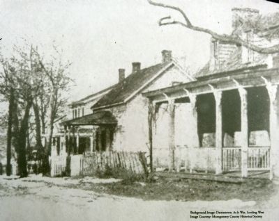
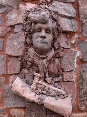
One of Beall's granddaughters, Elizabeth Gassaway, married William Darne in 1798. Elizabeth inherited the land originally named Mt. Pleasant. When the first post office was established ca. 1815-20, the town took Darne's name, as he was the largest land owner. Consequently, Darne was a slaveholder, owning 18 bondspeople who worked the fields. His wife Elizabeth, inherited the property upon his death in 1845. During his lifetime, William Darne served as a State Representative, Levy Court Judge, and later as director of the C&O Canal. The town was called "Darnes" or "Darnes Town" and eventually became known as Darnestown.
Canals & Trains
Darnestown's period of greatest prosperity mirrored the rise and fall of the Chesapeake& Ohio (C&O) Canal. This canal was an important part of the transportation of commercial goods from the mountains to tidewater, greatly reducing the time it took to get these goods from one place to another. Construction of the 184 mile canal began in 1828 and reached Cumberland, Maryland in 1850. Though railroads had already begun to surpass canal travel by this time, transportation of goods continued to be by canal in Darnestown. Farmers from surrounding areas brought their grain to the mills of Darnestown, where it was milled and transported via canal to Georgetown.
When the railroad came to Germantown and Gaithersburg by the early 1900s, the need for the canal decreased until it stopped operating in 1924. Commerce was drawn elsewhere and Darnestown's place as a crossroads center faded away with the end of the C&O canal.
Erected 2012 by Montgomery Parks.
Topics and series. This historical marker is listed in these topic lists: Railroads & Streetcars • Settlements & Settlers • Waterways & Vessels. In addition, it is included in the Chesapeake and Ohio (C&O) Canal series list. A significant historical year for this entry is 1600.
Location. 39° 6.197′ N, 77° 17.453′ W. Marker is in Darnestown, Maryland, in Montgomery County. Marker can be reached from Darnestown Road (Route 28) just east of Seneca Road (Route 112), on the left when traveling east. Marker is in Darnestown Square Heritage Park. Touch for map. Marker is at or near this postal address: 14039 Darnestown Road, Gaithersburg MD 20878, United States of America. Touch for directions.
Other nearby markers. At least 8 other markers are within walking distance of this marker. Andrew Small Academy (here, next to this marker); A 19th Century Crossroads (here, next to this marker); Clues to the Past: Oral History and Archaeology (here, next to this marker); Disease, Death, and Medical Discoveries During the Civil War (a few steps from this marker); Darnestown: A Strategic Point of Defense (within shouting distance of this marker); Civil War Troops & Darnestown Residents (within shouting distance of this marker); The Signal Corps and Wartime Communications (within shouting distance of this marker); The Civil War in Darnestown (within shouting distance of this marker). Touch for a list and map of all markers in Darnestown.
Photographed By Allen C. Browne, October 22, 2013
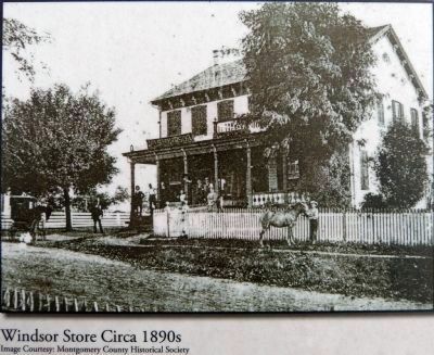
5. Windsor Store Circa 1890s
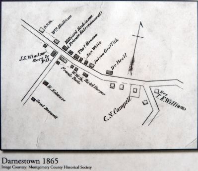
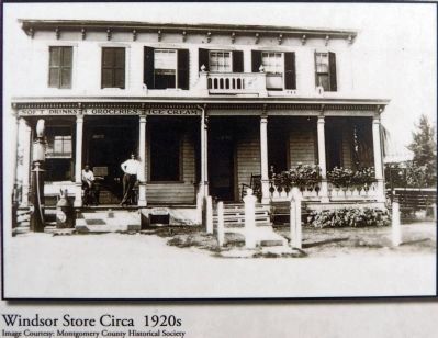
In addition to selling goods, Windsor Store served as Darnestown's post office. The store and post office was located at the southwest corner of the intersection of Darnestown and Seneca roads. During the 1800s mail arrived three times a week by stagecoach from Rockville and local people gathered for the arrival, creating a regular social event. The above images depict the store during different eras.
Close-up of photo on marker
Montgomery Historical Society
Montgomery Historical Society
Credits. This page was last revised on September 22, 2019. It was originally submitted on October 23, 2013, by Allen C. Browne of Silver Spring, Maryland. This page has been viewed 1,033 times since then and 51 times this year. Photos: 1, 2, 3, 4, 5, 6, 7. submitted on October 23, 2013, by Allen C. Browne of Silver Spring, Maryland. • Bill Pfingsten was the editor who published this page.
