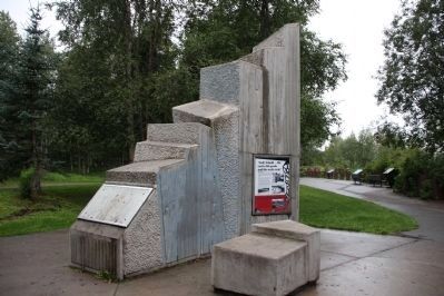
Anchorage, Alaska — Northwest (North America)
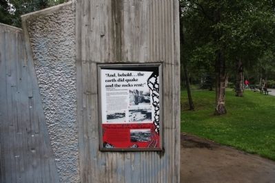
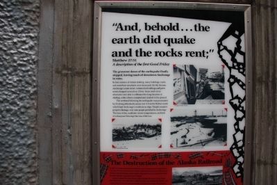
The Earth Did Quake
Matthew 27:51
A description of the first Good Friday
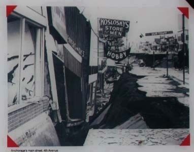
The gruesome dance of the earth finally stopped, leaving much of downtown Anchorage in ruins.
In four minutes of violent shaking, many buildings, roads, and waterfront structures were destroyed. On 4th Avenue, Anchorage's Main Street, commercial buildings and pavement dropped as much is 15 feet. Some multi-story structures were able to withstand the longer duration of shaking, while others crumpled and crashed to the ground.
The weekend following the earthquake was punctuated by 55 strong aftershocks (some over 5.0 on the Richter scale) which kept Anchorage’s residents on edge. Despite massive property damage, only nine people perished in Anchorage. The time of day, moderate winter temperatures, and lack of subsequent fires kept the loss of life low.
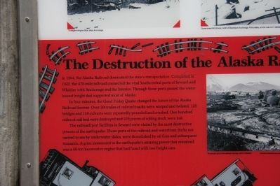
The Destruction of the Alaska Railroad
In 1964, the Alaskan Railroad dominated the state’s transportation. Completed in 1922, the 470 mile railroad connected the vital south-central ports of Seward and Whittier with Anchorage in the interior. Through these ports passed the waterborne freight that supported most of Alaska.
In four minutes, the Good Friday Quake changed the future of the Alaskan Railroad forever. Over 200 miles of railroad tracks were warped and twisted. 125 bridges and 110 culverts were repeatedly pounded and crushed. One hundred miles of rail bed were destroyed and 225 pieces of rolling stock were lost.
The railroad/port facilities in Seward were visited by the most destructive powers of the earthquake. Those parts of the railroad and waterfront dock not carried to sea by underwater slides were demolished by oil fires in subsequent tsunamis. A grim monument to the earthquake’s amazing power that remained was a 60-ton locomotive engine that had fused with two freight cars.
Topics. This historical marker is listed in this topic list: Disasters. A significant historical year for this entry is 1964.
Location. 61° 11.912′ N, 149° 58.81′ W. Marker is in Anchorage, Alaska. Marker is on West Northern Lights Boulevard. This marker is located in Earthquake Park on W Northern Lights Blvd. It is also accessible from the Tony Knowles Bicycle Trail. Parking is available on W Northern Lights Blvd. (N 61° 11.756 W 149° 58.578). From the parking lot, follow the paved path to the marker. Touch for map. Marker is in this post office area: Anchorage AK 99502, United States of America. Touch for directions.
Other nearby markers. At least 8 other markers are within 5 miles of this marker, measured as the crow flies. Turnagain Heights Slide (here, next to this marker); Measuring the Magnitude of Damage (a few steps from this marker); Tsunami! (within shouting distance of this marker); Anchorage Aloft! (about 400 feet away, measured in a direct line); Oscar Gill House (approx. 2½ miles away); Captain James Cook (approx. 2.9 miles away); Resolution Park 1776 / 1778 (approx. 2.9 miles away); What is this “Rock Man”? (approx. 4.3 miles away). Touch for a list and map of all markers in Anchorage.
Related marker. Click here for another marker that is related to this marker. To better understand the relationship, study each marker in the order shown.
Also see . . .
1. Great Alaskan earthquake of 1964. Source: You Tube video (Submitted on October 8, 2013, by Byron Hooks of Sandy Springs, Georgia.)
2. 1964 Alaska earthquake. Source: Wikipedia (Submitted on October 8, 2013, by Byron Hooks of Sandy Springs, Georgia.)
Credits. This page was last revised on August 29, 2020. It was originally submitted on October 8, 2013, by Byron Hooks of Sandy Springs, Georgia. This page has been viewed 841 times since then and 39 times this year. Last updated on October 28, 2013, by Byron Hooks of Sandy Springs, Georgia. Photos: 1, 2, 3, 4, 5, 6. submitted on October 8, 2013, by Byron Hooks of Sandy Springs, Georgia. • Syd Whittle was the editor who published this page.
