Near Petersburg in Dinwiddie County, Virginia — The American South (Mid-Atlantic)
Obstructions
The Military Encampment
— Pamplin Historical Park —
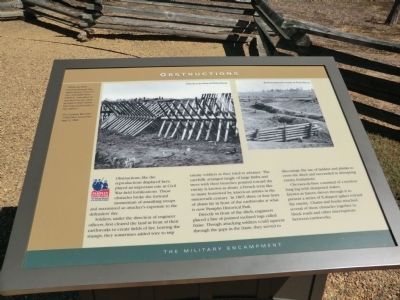
Soldiers, under the direction of engineer officers, first cleared the land in front of their earthworks to create fields of fire. Leaving the stumps, they sometimes added wire to trip enemy soldiers as they tried to advance. The carefully arranged tangle of large limbs and trees with their branches pointed toward the enemy is known as abates, a French term like so many borrowed by American armies in the nineteenth century. In 1865, three or four lines of abates lay in front of the earthworks at what is not Pamplin Historic Park.
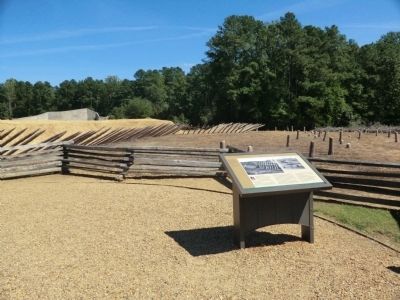
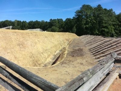
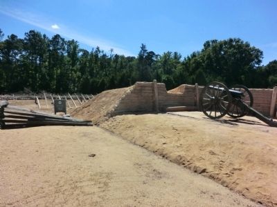
Directly in front of the ditch, engineers placed a line of pointed inclined logs called fraise. Though attacking soldiers could squeeze through the gaps in the fraise, they served to discourage the use of ladders and planks to cross the ditch and succeeded in disrupting enemy formations.
Chevaux-de-frise consisted of a ten-foot long log with sharpened stakes, known as lances, driven through to present a series of X-shaped spikes toward the enemy. Chains and hooks attached several of these obstacles together to block roads and other interruptions between earthworks.
“While we were…moving through the obstructions), seven of our…comrades were killed in…one place. It was dark but we were so close to their works that they could shoot us like rabbits.” –Pvt. Lorenzo Barnhart 110th Ohio Volunteers April 2, 1865
(captions)
Chevaux-de-frise at Petersburg
Earthworks with fraise at Petersburg
Erected by Pamplin Historical Park.
Topics. This historical marker is listed in this topic list: War, US Civil. A significant historical date for this entry is April 2, 1865.
Location. 37° 10.859′ N, 77° 28.613′ W. Marker is near Petersburg, Virginia, in Dinwiddie County. Marker can be reached from Boydton Plank Road (U.S. 1) 0.2 miles south of Duncan Road (Virginia Route 670), on the left when traveling south. Marker is located in Pamplin Historical Park. Touch for map. Marker is at or near this postal address: 6125 Boydton Plank Rd, Petersburg VA 23803, United States of America. Touch for directions.
Other nearby markers. At least 8 other markers are within walking distance of this marker. Field Fortifications (a few steps from this marker); The Military Landscape (within shouting distance of this marker); Kitchen Garden (about 400 feet away, measured in a direct line); Confederate Winter Quarters (about 400 feet away); Tobacco Barn (about 400 feet away); Tudor Hall Field Quarter (about 400 feet away); The Big House (about 400 feet away); The Breakthrough Trail (about 500 feet away). Touch for a list and map of all markers in Petersburg.
Credits. This page was last revised on February 2, 2023. It was originally submitted on November 3, 2013, by Don Morfe of Baltimore, Maryland. This page has been viewed 399 times since then and 15 times this year. Photos: 1, 2, 3, 4, 5. submitted on November 3, 2013, by Don Morfe of Baltimore, Maryland. • Bernard Fisher was the editor who published this page.
