Near Nancy in Wayne County, Kentucky — The American South (East South Central)
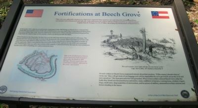
Fortifications at Beech Grove
"Their fort was admirable situated on a high piece of ground three-quarters of a mile from the Cumberland River, surrounded with a breastwork and rifle pits, with embrasures for cannon and as strong a position as could be found." — Captain John H. Putnam, Company H. 3rd Ohio, describing the fortifications at Beech Grove.
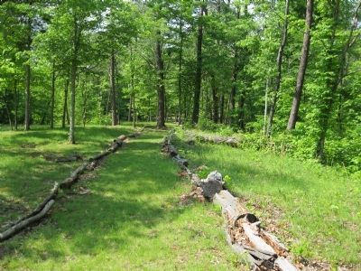
In December 1861, after he moved his base of operations from Mill Springs to Beech Grove, General Felix Zollicoffer instructed his men to build a line of fortifications one mile north of the Cumberland, stretching from the river to White Oak Creek. You now stand in the westernmost of three redoubts positioned along that line. Logs mark the original edges of the redoubt, which was destroyed after the battle.
When finished in late December, the line was over one mile long and enclosed an area of 1,000 acres. The breastwork here was ten feet high. In front of the breastwork was a trench fifteen feet deep and 10 feet wide. All of the trees were felled to create clear lines of fire. Some were placed in front of the trench to hinder an enemy approach. Others were used for firewood and to build winter quarters for the 6,000 men encamped here. Interestingly, there are cabin sites in front of the redoubt. Constructed before the redoubt, their inhabitants had the extra chore of building new cabins behind the lines.
Several soldiers in Beech Grove expressed concern about their position, "If (the enemy) should whip us," wrote one, "they will get most of our baggage as it will be impossible for us to get it back across the river and save ourselves." His fears proved to be well grounded. When Union soldiers entered Beech Grove after the battle they found one thousand horses and mules, many saddled or in harness, running loose, a battery wagon, forge, small arms, large quantities of ammunition, and ten pieces of artillery, ammunition in their caissons and horses standing in the traces.
Erected by Mill Springs Battlefield Association.
Topics. This historical marker is listed in this topic list: War, US Civil. A significant historical month for this entry is December 1861.
Location. 36° 57.238′ N, 84° 47.128′ W. Marker is near Nancy, Kentucky, in Wayne County. Marker can be reached from Mill Springs Battlefield Road, 3 miles south of Kentucky Route 235, on the right when traveling south. Marker is at the end of a trail at Tour Stop 7: Beech Grove Confederate Camp. Touch for map. Marker is in this post office area: Nancy KY 42544, United States of America. Touch for directions.
Other nearby markers. At least 8 other markers are within 2 miles of this marker, measured as the crow flies. Winter Quarters (within shouting distance of this marker); Beech Grove / Noble Ellis (about 600 feet away, measured in a direct
line); Zollie's Den (about 600 feet away); Respite at Moulden's Hill (approx. 0.6 miles away); The Noble Ellis Saves an Army (approx. 0.8 miles away); The Cumberland River (approx. 1˝ miles away); The Battle of Mill Springs (approx. 1˝ miles away); Home, Headquarters, Hospital (approx. 1˝ miles away). Touch for a list and map of all markers in Nancy.
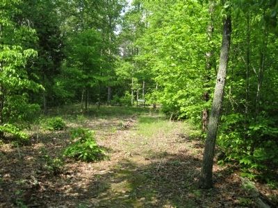
More about this marker. The trail to the marker is marked by two parallel lines of logs which also represent the edges of the redoubt.
The marker includes at lower left: Map of the fortifications at Beech Grove by Federal topographers after the Battle of Mill Springs. You now stand where the westernmost redoubt, indicated by the circle, was located.
Drawing at right: "We work in party's (sic) night and day on some breast works" — Captain Alex Coffee, 16th Alabama, December 9
Also see . . . Battle of Mills Spring. Wikipedia entry (Submitted on October 30, 2022, by Larry Gertner of New York, New York.)
Credits. This page was last revised on October 30, 2022. It was originally submitted on November 5, 2013, by David Graff of Halifax, Nova Scotia. This page has been viewed 516 times since then and 16 times this year. Photos: 1, 2, 3. submitted on November 5, 2013, by David Graff of Halifax, Nova Scotia. • Bernard Fisher was the editor who published this page.


