Fort Mason in San Francisco City and County, California — The American West (Pacific Coastal)
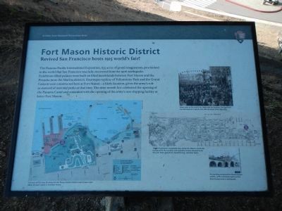
Fort Mason Historic District
Revived San Francisco hosts 1915 world’s fair!
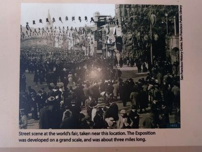
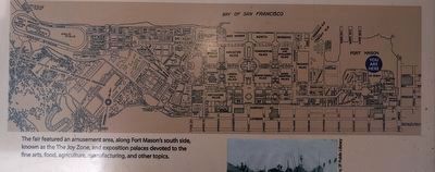
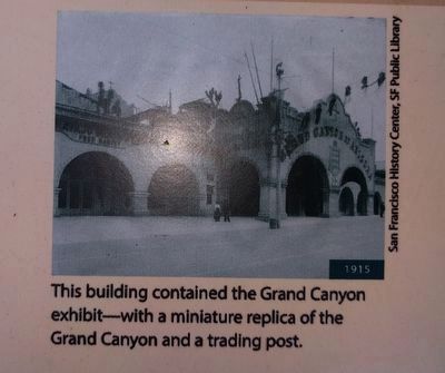
The Panama Pacific International Exposition, 635 acres of grand imagination, proclaimed to the world that San Francisco was fully recovered from the 1906 earthquake. Exhibition-filled palaces were built on filled marshlands between Fort Mason and the Presidio (now the Marina district). Enormous replicas of Yellowstone Park and the Grand Canyon were constructed here at Fort Mason—a likely location, given the army’s role as steward of national parks at that time. The nine-month fair celebrated the opening of the Panama Canal and coincided with the opening of the army’s new shipping facility at lower Fort Mason.
Erected by Golden Gate National Recreation Area.
Topics. This historical marker is listed in these topic lists: Entertainment • Forts and Castles. A significant historical year for this entry is 1906.
Location. 37° 48.387′ N, 122° 25.788′ W. Marker is in San Francisco, California, in San Francisco City and County. It is in Fort Mason. Marker is on San Francisco Bicycle Route 2, on the right when traveling west. Touch for map. Marker is in this post office area: San Francisco CA 94109, United States of America. Touch for directions.
Other nearby markers. At least 8 other markers are within walking distance of this marker. Brigantine Galilee (about 300 feet away, measured in a direct line); San Francisco Port of Embarkation (about 300 feet away); Phillip Burton (about 600 feet away); Golden Gate National Recreation Area Legislation (about 600 feet away); San Francisco Port of Embarkation (1932-1962) (about 600 feet away); a different marker also named Fort Mason Historic District (approx. 0.2 miles away); a different marker also named Fort Mason Historic District (approx. 0.2 miles away); Tubbs Cordage Building (approx. ¼ mile away). Touch for a list and map of all markers in San Francisco.
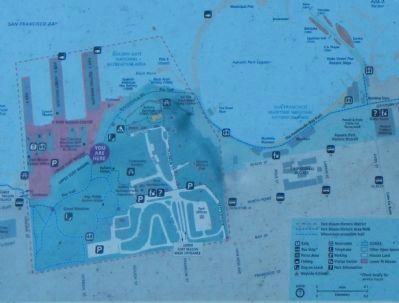
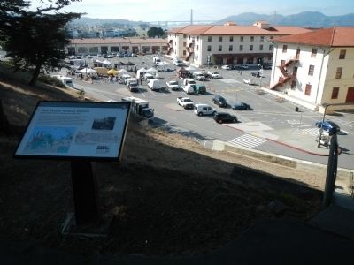
More about this marker. This marker is located on the bicycle path on the bluff overlooking lower Fort Mason.
Also see . . .
1. Fort Mason History. Fort Mason Center website entry:
The U.S. Army’s San Francisco Port of Embarkation played a critical role in the emergence of the United States as a world power. One of its first missions was delivering supplies and personnel to the western portion of the Panama Canal construction. (Submitted on November 5, 2013, by Barry Swackhamer of Brentwood, California.)
2. Panama-Pacific International Exposition. Wikipedia article about the 1915 World's Fair. (Submitted on April 17, 2019, by Joel Seewald of Madison Heights, Michigan.)
3. The 1915 World's Fair. Information about the Panama-Pacific International Exposition on the National Park Service website. (Submitted on April 17, 2019, by Joel Seewald of Madison Heights, Michigan.)
Additional keywords. Fort Mason
Credits. This page was last revised on February 7, 2023. It was originally submitted on November 5, 2013, by Barry Swackhamer of Brentwood, California. This page has been viewed 562 times since then and 13 times this year. Photos: 1, 2. submitted on November 5, 2013, by Barry Swackhamer of Brentwood, California. 3, 4, 5. submitted on April 17, 2019, by Joel Seewald of Madison Heights, Michigan. 6. submitted on November 5, 2013, by Barry Swackhamer of Brentwood, California. • Syd Whittle was the editor who published this page.
