Uniontown in Perry County, Alabama — The American South (East South Central)
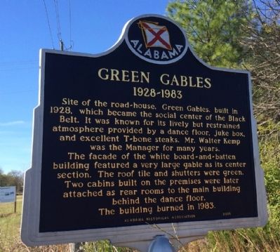
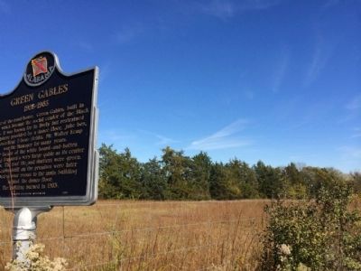
Green Gables
1928-1983
The facade of the white board-and-batten building featured a very large gable as its center section. The roof tile and shutters were green. Two cabins built on the premises were later attached as rear rooms to the main building behind the dance floor.
The building burned in 1983.
Erected 2005 by Alabama Historical Association.
Topics and series. This historical marker is listed in these topic lists: African Americans • Entertainment. In addition, it is included in the Alabama Historical Association series list. A significant historical year for this entry is 1928.
Location. 32° 26.99′ N, 87° 30.037′ W. Marker is in Uniontown, Alabama, in Perry County. Marker is on Washington Street (U.S. 80) 0.2 miles east of Village Avenue, on the left when traveling east. Touch for map. Marker is at or near this postal address: 1260 Washington Street, Uniontown AL 36786, United States of America. Touch for directions.
Other nearby markers. At least 8 other markers are within 11 miles of this marker, measured as the crow flies. Church of the Holy Cross (approx. one mile away); St. Michael's Cemetery (approx. 6.4 miles away); Paulling Place Cemetery (approx. 6.4 miles away); St. Michael's Episcopal Churchyard (approx. 6.4 miles away); Newbern Presbyterian Church (approx. 10.1 miles away); Freetown (approx. 10.2 miles away); Hobson Bethel Methodist Church (approx. 10.2 miles away); Newbern Baptist Church (approx. 10.3 miles away).
Also see . . . The Black Belt in the American South. The Black Belt in the American South refers to the social history, especially concerning slavery and black workers, of the geological region known as the Black Belt. (Submitted on October 23, 2020, by Byron Hooks of Sandy Springs, Georgia.)
Credits. This page was last revised on October 23, 2020. It was originally submitted on November 8, 2013, by Mark Hilton of Montgomery, Alabama. This page has been viewed 1,048 times since then and 55 times this year. Photos: 1, 2. submitted on November 8, 2013, by Mark Hilton of Montgomery, Alabama. • Bernard Fisher was the editor who published this page.

