Yreka in Siskiyou County, California — The American West (Pacific Coastal)
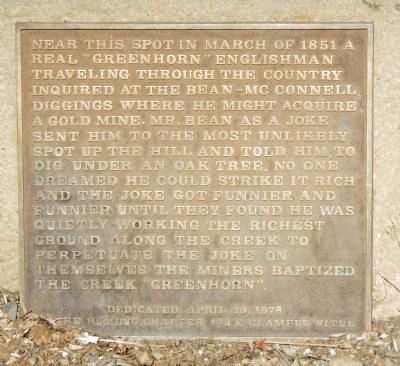
Greenhorn
The Humbug Chapter #73 E Clampus Vitus
Erected 1978 by E Clampus Vitus, Humbug Chapter 73.
Topics and series. This historical marker is listed in this topic list: Settlements & Settlers. In addition, it is included in the E Clampus Vitus series list. A significant historical month for this entry is March 1851.
Location. 41° 42.766′ N, 122° 39.38′ W. Marker is in Yreka, California, in Siskiyou County. Marker can be reached from Greenhorn Road, on the left when traveling west. Touch for map. Marker is at or near this postal address: 516 Greenhorn Road, Yreka CA 96097, United States of America. Touch for directions.
Other nearby markers. At least 8 other markers are within 2 miles of this marker, measured as the crow flies. Moonlit Oaks Dance Pavilion / Clyde Johnson Lynching (approx. 0.8 miles away); No. 4 Kingpin Hydraulic Giant (approx. 1.2 miles away); Randolph Collier (approx. 1.6 miles away); Clampers Meeting Hall (approx. 1.6 miles away); Witherill Building (approx. 1.6 miles away); Witherill/Winckler Building (approx. 1.6 miles away); First Log House (approx. 1.6 miles away); Charles Bibend Building (approx. 1.6 miles away). Touch for a list and map of all markers in Yreka.
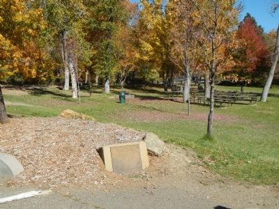
More about this marker. The marker is located in the Greenhorn Park parking lot.
Credits. This page was last revised on June 16, 2016. It was originally submitted on November 10, 2013, by Barry Swackhamer of Brentwood, California. This page has been viewed 481 times since then and 15 times this year. Photos: 1, 2, 3. submitted on November 10, 2013, by Barry Swackhamer of Brentwood, California. • Andrew Ruppenstein was the editor who published this page.


