St. Simons Island in Glynn County, Georgia — The American South (South Atlantic)
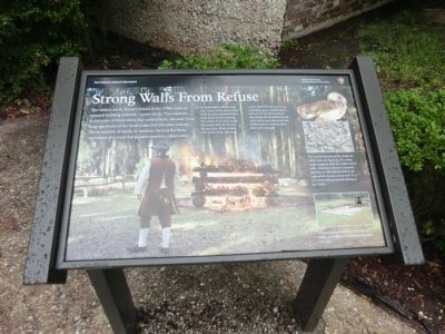
Strong Walls From Refuse
Fort Frederica National Monument
The settlers of St Simon’s Island in the 1700s used an unusual building material—oyster shells. The colonists found piles of them when they arrived here, discards from long-ago feasts of the local Guale and Mocama Indians. These mounds of shells, or middens, formed the basic ingredient of a crude but durable concrete called tabby.
(captions)
(background) To make tabby, stacked logs and oyster shells, called ricks, were set afire and allowed to burn down to hot embers. The shells were burnt to ash. The wood and ash mixture formed lime. When mixed with water, sand, and more oyster shells the lime served as a binding agent, solidifying the mixture. It was then poured into molds for foundations and walls which were stuccoed and whitewashed to protect them from water damage.
(upper right) The settlers borrowed the recipe for tabby from the Spanish. The word might originate with the Arabic word tabbi, meaning a mixture of mortar and lime or with the Spanish word tapia which means a mud wall. It’s a very old building material dating to the 1500s.
(lower right) The strong walls and foundations of many of Frederica’s buildings are built of tabby.
Erected by National Park Service.
Topics. This historical marker is listed in these topic lists: Colonial Era • Forts and Castles • Settlements & Settlers.
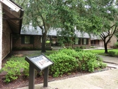
Location. 31° 13.398′ N, 81° 23.364′ W. Marker is on St. Simons Island, Georgia, in Glynn County. Marker can be reached from Mimosa Drive, 0.1 miles west of Frederica Drive, on the right when traveling west. The marker is located on the grounds of Fort Frederica National Monument. Touch for map. Marker is at or near this postal address: 6515 Frederica Drive, Saint Simons Island GA 31522, United States of America. Touch for directions.
Other nearby markers. At least 8 other markers are within walking distance of this marker. Fort Frederica (a few steps from this marker); The World Is My Parish (within shouting distance of this marker); The Defender (within shouting distance of this marker); Broad Street (within shouting distance of this marker); The Town Wall (within shouting distance of this marker); Frederica - Old Burial Ground (within shouting distance of this marker); Frederica - Military Road (about 300 feet away, measured in a direct line); Frederica (about 300 feet away). Touch for a list and map of all markers in St. Simons Island.
Also see . . . Fort Frederica National Monument. (Submitted on November 13, 2013.)
Credits. This page was last revised on April 8, 2022. It was originally submitted on November 12, 2013, by Don Morfe of Baltimore, Maryland. This page has been viewed 492 times since then and 8 times this year. Photos: 1, 2. submitted on November 12, 2013, by Don Morfe of Baltimore, Maryland. • Bernard Fisher was the editor who published this page.

