Fort Jones in Siskiyou County, California — The American West (Pacific Coastal)
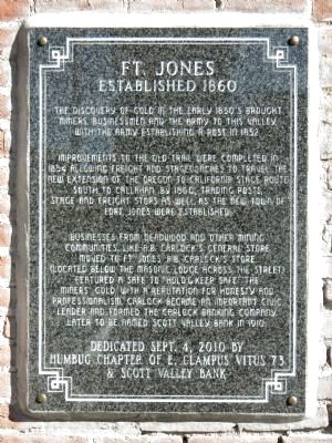
Fort Jones
Established 1860
Improvements to the old trail were completed in 1854 allowing freight and stagecoaches to travel the new extension of the Oregon to California Stage Route south to Callahan by 1860. Trading posts, stage and freight stops as well as the new town of Fort Jones were established.
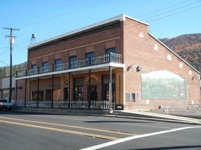
Businesses from Deadwood and other mining communities, like Carlock’s general store (located below the Masonic Lodge across the street) featured a safe to “hold & keep safe” the miner’s gold. With a reputation for honesty and professionalism, Carlock became an important civic leader and formed the Carlock Banking Company, later to be named Scott Valley Bank in 1910.
Dedicated Sept. 4, 2010 by
Humbug Chapter of E. Clampus Vitus 73
& Scott Valley Bank
Erected 2010 by E Clampus Vitus, Humbug Chapter 73 & Scott Valley Bank.
Topics and series. This historical marker is listed in this topic list: Settlements & Settlers. In addition, it is included in the E Clampus Vitus series list. A significant historical date for this entry is September 4, 1851.
Location. 41° 36.401′ N, 122° 50.515′ W. Marker is in Fort Jones, California, in Siskiyou County. Marker is on Main Street (California Route 3), on the right when traveling north. Touch for map. Marker is at or near this postal address: 11890 Main Street, Fort Jones CA 96032, United States of America. Touch for directions.
Other nearby markers. At least 8 other markers are within 8 miles of this marker, measured as the crow flies. “Fort Jones House” (about 500 feet away, measured in a direct line); Fort Jones War Memorial (about 600 feet away); World Wars Memorial (about 600 feet away); a different marker also named Fort Jones (approx. ¾ mile away); Sgt. James Bryan (approx. one mile away); Veterans Memorial (approx. 1.2 miles away); Meamber School (approx. 6.1 miles away); Robbers Rock (approx. 7.9 miles away). Touch for a list and map of all markers in Fort Jones.
Credits. This page was last revised on June 16, 2016. It was originally submitted on November 16, 2013, by Barry Swackhamer of Brentwood, California. This page has been viewed 481 times since then and 24 times this year. Photos: 1, 2, 3. submitted on November 16, 2013, by Barry Swackhamer of Brentwood, California. • Al Wolf was the editor who published this page.


