Hendersonville in Colleton County, South Carolina — The American South (South Atlantic)
Hendersonville / Arab The Horse
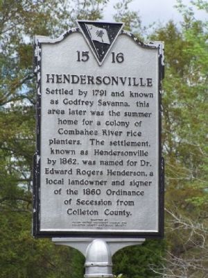
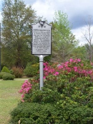
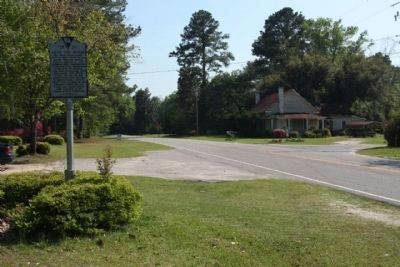
Settled in 1791 and known as Godfrey Savannah, this area later was the summer home for a colony of Combahee River rice planters. The settlement, known as Hendersonville by 1862, was named for Dr. Edward Rogers Henderson, a local landowner and signer of the 1860 Ordinance of Secession from Colleton County.
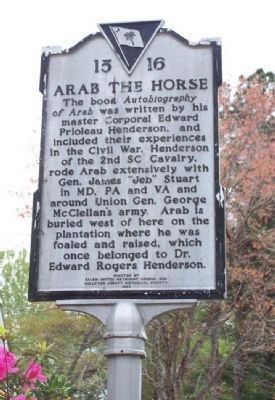
The book Autobiography of Arab was written by his master Corporal Edward Priolean Henderson, and included their experiences in the Civil War. Henderson of the 2nd SC Calvary, rode Arab extensively with Gen. James "Jeb" Stuart in MD, PA and VA and around Union Gen. George McClellen's army. Arab is buried west of here on the plantation where he was foaled and raised, which once belonged to Dr. Edward Rogers Henderson.
Erected 1993 by Salem United Methodist Church and Colleton County Historical Society. (Marker Number 15-16.)
Topics. This historical marker is listed in these topic lists: Animals • Notable Places • War, US Civil. A significant historical year for this entry is 1791.
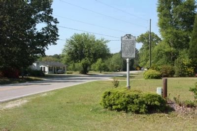
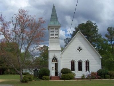
Location. 32° 47.623′ N, 80° 43.501′ W. Marker is in Hendersonville, South Carolina, in Colleton County. Marker is on Hendersonville Highway (U.S. 17A), on the right when traveling north. Next to the Methodist Church. Touch for map. Marker is at or near this postal address: 7163 Hendersonville Highway, Walterboro SC 29488, United States of America. Touch for directions.
Other nearby markers. At least 8 other markers are within 9 miles of this marker, measured as the crow flies. Catholic Hill (approx. 3.8 miles away); 150 Years Of Faith at St. James Church (approx. 3.8 miles away); Salkehatchie Presbyterian Church (approx. 6˝ miles away); Colleton County Courthouse (approx. 8.2 miles away); Confederate Monument (approx. 8.2 miles away); Walterboro (approx. 8.3 miles away); Walterboro Jail (approx. 8.3 miles away); Colleton County Veterans War Memorial (approx. 8.3 miles away).
Also see . . . Hampton's Legion. (Submitted on April 12, 2008, by Mike Stroud of Bluffton, South Carolina.)
Additional commentary.
1. Autobiography of Arab
by Henderson, E. Prioleau
A reprint of a unique story about Arab, a cavalry horse of the Civil War. A rare title in that the horse wrote the book! Henderson, Arab's master for many years, slips easily from horse to human voice in recounting their phenomenal experiences together.
As a member of the old and much respected Beaufort District Troop, Henderson entered Confederate service with the newly formed Hampton Legion. From mustering in to the final gun, Henderson served with Legion, which was attached to the 2d South Carolina Cavalry, as one of the "Iron Scouts" of Stuart and Hampton. Chief among the participants in Henderson's narrative is his close friend Sgt. William Mickler, who was one of the most daring of all Confederate scouts. His adventures, courage, and devotion to the success of the Confederate effort, both in Virginia and South Carolina, rival any account to come out of the war.
— Submitted April 13, 2008, by Mike Stroud of Bluffton, South Carolina.
Credits. This page was last revised on August 5, 2021. It was originally submitted on April 12, 2008, by Mike Stroud of Bluffton, South Carolina. This page has been viewed 2,451 times since then and 39 times this year. Photos: 1. submitted on April 17, 2012, by Mike Stroud of Bluffton, South Carolina. 2, 3. submitted on April 12, 2008, by Mike Stroud of Bluffton, South Carolina. 4, 5. submitted on April 11, 2011, by Mike Stroud of Bluffton, South Carolina. 6. submitted on April 12, 2008, by Mike Stroud of Bluffton, South Carolina. • Craig Swain was the editor who published this page.
