Petersburg, Virginia — The American South (Mid-Atlantic)
Dividing Point
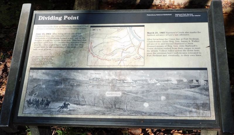
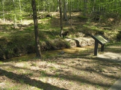
June 15, 1864 After being driven out of the Dimmock Line, the outnumbered Confederate defenders of Petersburg formed a new line on the heights across the stream from you. They held this position until June 17 - weathering repeated Union attacks - then pulled back safely to the line they would hold for the remainder of the siege, a half mile west of here.
March 25, 1865 Harrison’s Creek also marks the farthest advance of Lee’s last offensive.
After breaching the Union lines at Fort Stedman, Confederates under Brig. Gen. James A. Walker advanced to and beyond Harrison’s Creek. Pennsylvanians of Brig. Gen. John Hartranft’s Union division rushed from their camps to meet the attack. Volleys rolled across the fields here; soon the overmatched Confederates retreated to Fort Stedman and, eventually, to their own lines.
Erected by National Park Service, U.S. Department of the Interior.
Topics. This historical marker is listed in this topic list: War, US Civil. A significant historical month for this entry is March 1865.
Location. 37° 13.953′ N, 77° 21.811′ W. Marker is in Petersburg, Virginia. Marker is on Siege Road, on the right when traveling south. Marker is in Petersburg National Battlefield at Tour Stop 4 on the Auto Tour Road. Touch for map. Marker is in this post office area: Petersburg VA 23803, United States of America. Touch for directions.
Other nearby markers. At least 8 other markers are within walking distance of this marker. Prince George Court House Road (approx. 0.3 miles away); Siege of Petersburg—Lee Strikes Back (approx. 0.3 miles away); A Final Effort (approx. 0.3 miles away); Fort Stedman (approx. 0.3 miles away); a different marker also named Fort Stedman (approx. 0.4 miles away); Battery 8 of the Dimmock Line (approx. 0.4 miles away); Wasted Valor (approx. half a mile away); First Maine Heavy Artillery Monument (approx. half a mile away). Touch for a list and map of all markers in Petersburg.
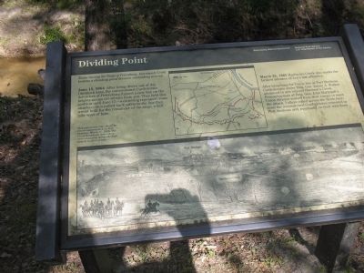
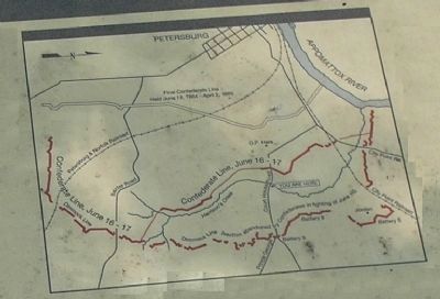
More about this marker. The upper center of the marker contains a map of the Confederate defensive lines during the 1864-65 siege.
The bottom of the marker features a sketch of the siege lines showing the locations of Fort Stedman, Harrison’s Creek and the marker itself. It includes the caption This panoramic view shows the Union counterattack on Fort Stedman, March 25, 1865. The Union battlelines shown here were advancing across the high ground in front of you.
Also see . . .
1. The Siege of Petersburg. (Submitted on April 12, 2008, by Bill Coughlin of Woodland Park, New Jersey.)
2. Petersburg National Battlefield. National Park Service. (Submitted on April 12, 2008, by Bill Coughlin of Woodland Park, New Jersey.)
Credits. This page was last revised on February 2, 2023. It was originally submitted on April 12, 2008, by Bill Coughlin of Woodland Park, New Jersey. This page has been viewed 1,461 times since then and 46 times this year. Photos: 1. submitted on November 13, 2021, by Bradley Owen of Morgantown, West Virginia. 2, 3, 4. submitted on April 12, 2008, by Bill Coughlin of Woodland Park, New Jersey. 5. submitted on November 13, 2021, by Bradley Owen of Morgantown, West Virginia. • Craig Swain was the editor who published this page.


